


Arctic Front Approaches Texas: Impact on Greater Houston Explained
The arrival of a winter storm in the Greater Houston area is expected this weekend, with significant impacts anticipated due to an Arctic front. As temperatures plummet, residents should prepare for potential freezing conditions and icy roads.
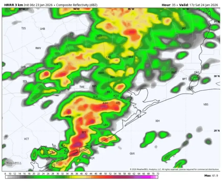
Winter Storm Overview
This Arctic front is forecasted to reach Houston on Saturday. While Friday is expected to remain mild, thunderstorms may develop Saturday morning. This precipitation is likely to fall as rain, which is crucial for anticipating later freezing conditions.
Friday Forecast
- Morning fog with temperatures around 60°F.
- Highs may reach the upper 60s and skies will be mostly cloudy.
- A few light showers are possible, but they are not expected to cause significant concerns.
As the cold front moves in, temperatures will drop into the 50s overnight.
Saturday Expectations
On Saturday, conditions will shift as warm, moist air meets colder air inland. This setup is likely to result in thunderstorms during the mid-morning. Rainfall amounts could reach between 0.5 to 1.0 inches quickly.
- Temperatures will hover around 50°F, allowing rain instead of freezing conditions.
- After Saturday morning’s storms, the afternoon may see a temporary break in precipitation with mostly cloudy skies.
Later Saturday evening, freezing temperatures may start to approach the area, particularly affecting Montgomery County initially, with possible impacts in Harris County thereafter.
Sunday Forecast
Sunday presents uncertainty regarding temperatures. Light showers are expected overnight into Sunday, with a chance of freezing conditions over the metro area as the day progresses. Residents are advised to check local temperatures closely.
- There’s a 50% possibility of temperatures dropping below freezing in certain areas.
- Minor ice accumulation could occur in Montgomery County, particularly along and north of Highway 105.
If temperatures remain above freezing, areas are likely to experience only cold rain. The key to road conditions lies in whether any freezing occurs overnight.
Monday and the Week Ahead
Road conditions on Monday morning will depend on the situation from Sunday night. As no additional precipitation is expected, dry roads from the previous evening will likely remain clear. Highs on Monday are anticipated between 35°F and 40°F.
Subsequent days are expected to bring slightly warmer conditions, with highs in the 50s and lows in the 30s. Yet, another Arctic front could arrive later in the week, with the potential for snow as well.
Preparation Tips for Freezing Conditions
Residents should take precautions to stay warm during the impending freeze. Here are some useful tips:
- Use space heaters in high-traffic rooms to reduce heating costs.
- Set thermostats to 68°F while awake and lower it overnight.
- Utilize thermal drapes to block drafts and retain warmth.
- Consider smart plugs to manage device power consumption remotely.
- Layer clothing to maintain warmth without increasing heating usage.
- Ensure windows and doors are weatherstripped to trap heat effectively.
Be prepared for varying weather conditions as the weekend approaches and stay informed via reliable local resources like Filmogaz.com.