


Arctic Cold and Lake Effect Snow to Hit Michigan This Weekend
The state of Michigan is bracing for severe winter weather this weekend, characterized by an Arctic cold front and significant lake effect snow. A Winter Storm Warning is currently in place for Oceana, Muskegon, and Ottawa counties. Winter Weather Advisories stretch across much of southern Lower Michigan.
Forecast Overview
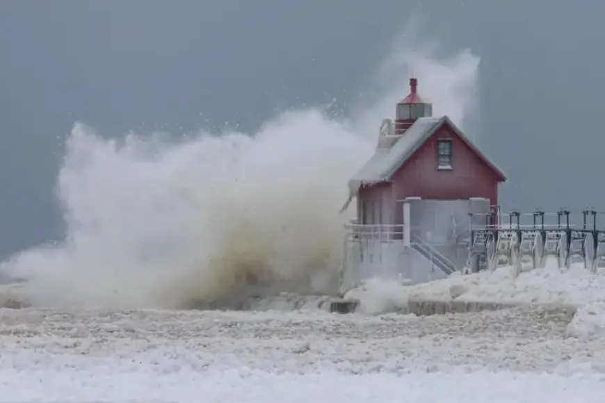
Snowfall is expected to vary across the region, with total accumulations reaching between 9 to 12 inches in communities along the Lake Michigan shoreline. In contrast, Southeast Michigan may see only 1 to 3 inches. Temperatures today are rising slightly, with areas in the southern part of the state reaching the low 30s. Meanwhile, the Upper Peninsula can expect highs near 20 degrees.
Cold Air Mass Incoming
The National Weather Service has alerted residents about a dangerously cold air mass approaching Michigan. This front is anticipated to bring the coldest temperatures the state has experienced since 2019.
Key Weather Highlights
- Potentially life-threatening cold expected starting Thursday night.
- Temperatures may plummet below zero, with wind chills hitting minus 35 degrees or colder.
- Light to moderate snow will ease off today but lake effect snow will return to the Lake Superior regions.
- Additional snow accumulations of 3 to 6 inches are forecast for the Keweenaw Peninsula.
Travel Hazards
Travel conditions are predicted to be hazardous due to blowing snow and reduced visibility. The system will elevate winds up to 20 mph combined with light powdery snow, primarily threatening travel on Thursday night and Friday afternoon.
Temperature Forecast
- Temperatures across the Upper Peninsula and northern Lower Michigan may drop to minus 15 degrees or lower by Friday morning.
- An Extreme Cold Watch is in effect for western and central Upper Michigan, with apparent temperatures potentially falling below minus 25 degrees.
- Southern Lower Michigan will also see single-digit highs and subzero overnight lows through the weekend.
The frigid conditions are expected to last at least through Sunday morning, providing sustained challenges for residents. Though lake effect snow will linger throughout the weekend, accumulations may be limited due to the extremely cold temperatures producing smaller snowflakes.
Stay tuned to Filmogaz.com for ongoing weather updates and safety information as this Arctic cold and lake effect snow impact the state.