


Why Trump Covets Greenland’s Strategic Location: A Seven-Map Analysis
Amid ongoing discussions at the World Economic Forum (WEF) in Davos, Switzerland, US President Donald Trump’s interest in Greenland’s strategic location has intensified. This interest escalates as tensions arise over potential tariffs and military considerations related to acquiring the autonomous territory, which is part of Denmark.
Greenland’s Importance to Global Security
Trump emphasized the unique value of Greenland for national and world security during a media briefing. He has warned several European nations, including the UK, Denmark, and Norway, of impending tariffs unless they support his proposal for Greenland’s acquisition. Starting February 1, a 10% tariff on goods from these nations will increase to 25% by June. This threat has alarmed European leaders, who fear a trade war and fracture of NATO relations.
Geography and Demographics of Greenland
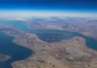
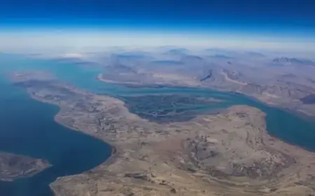
Greenland is the largest island globally, situated mainly within the Arctic Circle, bordered by the Arctic and Atlantic Oceans. Politically, it is an autonomous territory of Denmark, while geographically it falls under North America, lying northeast of Canada. The island spans approximately 2.17 million square kilometers (836,330 square miles), similar in size to Saudi Arabia and three times larger than Texas.
About 80% of Greenland is blanketed by the Greenland Ice Sheet, the second-largest ice mass on Earth. The majority of its population, around 56,000 individuals, resides along the coastline, with Nuuk serving as the capital and home to one-third of the inhabitants.
Greenland’s Strategic Military Presence
The Pituffik Space Base, located in northwestern Greenland, is a key military installation for the US. This base plays a critical role in missile defense, satellite command, and monitoring Russian activities in the Arctic. Approximately 650 personnel from various nations operate at Pituffik, underscoring the strategic military significance of the region.
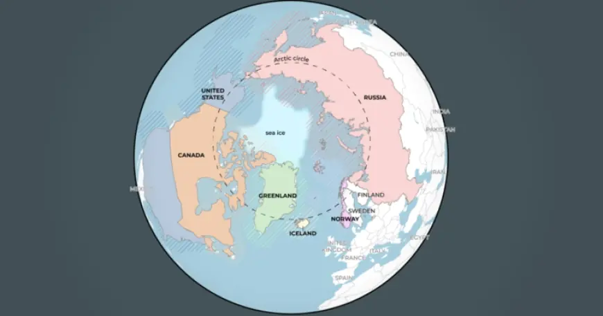
Arctic Geography and Trade Routes
The Arctic Circle encompasses eight countries, including Canada, Iceland, and the United States. Notably, the closest point between Canada and Greenland is merely 26 kilometers (16 miles) apart, separated by the Nares Strait. The region’s shipping routes have gained prominence due to shrinking ice, resulting in a 37% increase in Arctic shipping traffic from 2013 to 2023.
The main Arctic shipping routes include:
- Northern Sea Route (NSR): Runs along Russia’s Arctic coast, shortening travel time significantly compared to the Suez Canal.
- Northwest Passage (NWP): Cuts through Canada’s Arctic, offering faster transit between Asia and Europe.
- Transpolar Sea Route (TSR): Connects the Atlantic and Pacific directly through the Arctic, though it is rarely used due to sea ice.
Greenland’s Rich Natural Resources
Greenland is abundant in minerals like gold, iron ore, and rare earth elements crucial for modern technology. In addition, deposits of zinc, copper, and diamonds have attracted significant international attention. Exploration efforts continue, particularly for untapped resources in areas like the northeast and central east.
Historical Context of Greenland’s Autonomy
Inuit people were the first settlers around 2500 BCE, followed by Norse explorers in the 10th century. Greenland came under Danish colonial rule in 1721 and achieved self-governance in 1979. While Denmark manages foreign policy and defense, Greenland has autonomy over its internal affairs and natural resources.
Strategically located, Greenland has remained vital for military activity throughout history, especially during World War II and the Cold War. The current dynamics surrounding its acquisition highlight the ongoing interest from global powers in the region’s geopolitical and economic potential.