


High Winter Storm Threat Looms for N.J. Weekend; Snow Totals Uncertain
The New Jersey region is bracing for a potentially significant winter storm this weekend. Forecasters indicate a high chance of impactful weather conditions, but uncertainties remain concerning snowfall amounts and the storm’s path.
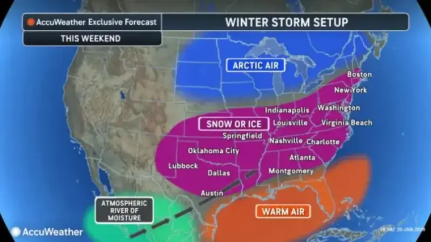
Winter Storm Forecast for New Jersey
The National Weather Service (NWS) is closely monitoring the storm system expected to affect New Jersey from late Saturday through late Sunday. The consensus among various forecasting models has raised snowfall probabilities considerably in recent days.
- 70% to 90% chance of 2 inches or more of snow.
- 60% to 80% chance of 6 inches or more of snow for areas south of Philadelphia.
- 80% or higher chance of accumulating at least half a foot of snow in southern New Jersey.
- 40% to 60% probability of 6 inches or more in northern areas, particularly those northwest of Interstate 95.
Timeline of the Storm
Snow and precipitation are expected to begin Saturday night, continuing through Sunday night. Depending on the storm’s progression, conditions could persist into Monday. However, uncertainties remain as the critical atmospheric energy driving the storm is still far from New Jersey.
Potential Impact on Snow Accumulation
AccuWeather predicts that while New Jersey may experience substantial snow, factors like rain, sleet, or dry air could limit accumulations. Forecasters suggest that colder regions of the storm might see snowfall totals between 6 and 12 inches.
Current Weather Conditions in New Jersey
Before the storm arrives, New Jersey is experiencing bitterly cold conditions. Low temperatures are expected to range between zero and ten degrees Fahrenheit, creating dangerously low wind chills, particularly on Tuesday night.
- Low air temperatures between 0°F and 10°F tonight.
- Wind chill values expected to drop to the low single digits.
- Brief relief from cold temperatures forecast for Wednesday, with highs in the 30s to low 40s.
Looking Ahead
Temperature conditions are expected to shift dramatically as an arctic cold front moves through on Friday. Following this front, daytime highs will approach freezing, but nighttime lows could drop to single digits by Saturday morning. Gusty winds may further lower the apparent temperature to below zero.
Overall, a prolonged period of frigid weather is anticipated following the storm, with temperatures expected to stay subfreezing through the following week. New Jersey residents should remain alert to changing weather conditions and prepare accordingly.