


Winter Weather Advisory Updates: Wednesday Morning Snow and Ice Threats Grow, Bigger Late-Week Storm Looms
A fresh wave of winter weather advisories is lining up across parts of the Midwest and Great Lakes, with the biggest concern focused on the Wednesday morning commute (January 21, 2026). While many areas are looking at “manageable” totals, the mix of light snow, freezing drizzle, and below-freezing road temperatures can turn routine travel into a slow, slippery grind in a hurry. At the same time, attention is already shifting to a broader, higher-impact storm signal later this week that could spread ice and snow well beyond the usual winter hot spots.
What a Winter Weather Advisory Means (and What It Doesn’t)
A winter weather advisory is issued when winter precipitation is expected to create travel hazards, but conditions are not forecast to meet the more severe thresholds associated with a winter storm warning. In plain terms: it’s a heads-up that roads and sidewalks can become dangerous, visibility may drop at times, and delays are likely—especially during peak drive times—even if this isn’t a blockbuster blizzard.
Winter Weather Advisory Focus: Chicago-Area Snow Bands Overnight
In northern Illinois and nearby counties, advisories were expanded ahead of a late-evening and overnight snow push. Several counties are expected to see a corridor of steadier snow, with totals commonly in the 2–5 inch range and the highest potential closer to the Wisconsin–Illinois line. The main hazard window targets late Tuesday night into early Wednesday, when roads can snow over faster than crews can fully keep up—particularly on bridges, ramps, and untreated neighborhood streets.
A second, follow-on burst of wintry weather is also on the radar for later Wednesday, with gustier winds capable of producing areas of blowing and drifting snow, even after the first round eases.
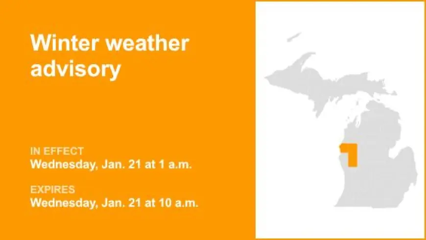
Winter Weather Advisory for Southeast Michigan: Commute-Timed Snow, Quick Accumulations
Across Southeast Michigan, a winter weather advisory covers the pre-dawn through early afternoon hours on Wednesday, with snow developing mainly after 3 a.m. and tapering later in the day. Snow totals are generally projected around 1–3 inches, but timing is the bigger story: the steadiest snowfall overlaps the morning commute, when cold pavement temperatures allow snow to stick quickly.
Even modest accumulation can snarl traffic when it falls during peak travel. Expect the slickest conditions on side streets, overpasses, and highway ramps, with occasional visibility drops during heavier bursts.
Winter Weather Advisory Near the Ohio Valley: Freezing Drizzle Risk and a “Glaze” Scenario
Farther south in the Ohio Valley region, the concern shifts from mostly snow to a more treacherous mix. An advisory window centers on early Wednesday morning, when freezing drizzle or light freezing rain may form along a passing front. With road temperatures well below freezing overnight, even a thin glaze can create widespread slick spots before surface temperatures recover later in the morning.
This setup often produces the most deceptive driving conditions of the season: roads may look merely wet, but traction can vanish instantly—especially on elevated surfaces.
Timing Snapshot: When the Highest-Risk Travel Period Hits
| Region | Primary Hazard | Most Sensitive Window |
|---|---|---|
| Chicago-area counties | Snow bands, locally higher totals | Late Tuesday night into early Wednesday morning |
| Southeast Michigan | 1–3" snow, fast stick on cold pavement | 3 a.m. to late morning Wednesday |
| Ohio Valley pockets | Freezing drizzle/freezing rain glaze | Early morning Wednesday through mid-morning |
Cold Reinforces the Hazard: Why “Small” Storms Still Cause Big Disruptions
Cold is the multiplier. Single-digit temperatures and subzero wind chills mean road treatments can be less effective, refreeze can happen quickly after plows pass, and stranded drivers face higher risk if delays stretch out. Even where snowfall totals stay modest, cold pavement and wind-driven bursts can keep conditions worse than they look—particularly at daybreak.
Looking Ahead: Late-Week Storm Signals Raise the Stakes
Beyond the midweek advisories, a broader storm pattern is taking shape for Friday into the weekend, with the potential to spread significant ice and snow from parts of Texas toward the Southeast. Early preparations have already begun in some areas, reflecting the higher-end risk that ice can bring: downed trees, power outages, and impassable roads in places that don’t handle frequent winter storms.
Details will sharpen as the event draws closer, but the key takeaway is this: midweek advisories may be the first act, not the finale.
Practical Moves if You’re Under a Winter Weather Advisory
-
Leave extra time and assume your commute will be slower than usual.
-
Slow down early; gentle braking and wider following distance matter most on bridges and ramps.
-
Keep your fuel tank higher than normal and carry a basic winter car kit (blanket, charger, scraper, flashlight).
-
Watch for “black ice” conditions near sunrise and in shaded areas.
-
If freezing drizzle is in play, treat any “wet-looking” road as suspect until proven otherwise.
As advisories expand and timing tightens, the smartest play is to treat Wednesday morning as a high-friction travel period—even if totals sound small. The road impact is often decided by temperature, timing, and precipitation type, not just inches.


