


Major Winter Storm to Unleash Dangerous Ice and Snow Across Eastern USA
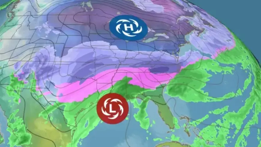
A significant winter storm is set to impact the eastern United States with hazardous ice and snow, beginning late this week. This storm is fueled by a strong Arctic air mass, bringing the coldest temperatures of the season. The National Weather Service warns that major travel disruptions are likely due to extreme conditions.
Forecast Overview
The storm is predicted to intensify in the Plains on Friday and will travel across the U.S. towards the East Coast by Sunday. It is expected to bring heavy snow, sleet, and dangerous freezing rain over a large area stretching from the Southern Rockies and Plains towards North Carolina and Virginia. The National Weather Service has already issued winter storm watches for several regions.
Areas Affected
- Oklahoma
- Northern Texas
- Arkansas
- North Carolina
- Virginia
- Northern and Eastern Georgia
- Parts of the Carolinas
Potential Impacts
The combination of snow and ice could disrupt travel across a vast area, from the Southern and Central Plains to the East Coast. The greatest risk lies in the potential for significant icing, which can accumulate to a quarter- to half-inch. This amount is sufficient to damage infrastructure, leading to fallen trees and downed power lines.
Snow Predictions
In areas north of the ice zone, considerable snow accumulations are expected. The storm will likely affect regions from Oklahoma and northern Texas to the mid-Atlantic. Snow and ice may continue into Monday along parts of the East Coast, depending on the storm’s progress and behavior.
Cold Temperatures
Temperatures are expected to drop significantly, with some areas experiencing highs around 30 degrees below average. The Arctic air mass will spread its effects as it moves south and east, leading to extremely low temperatures in the Midwest and potentially record-setting cold in some locations.
Record Low Temperatures
| Location | Expected Temperature |
|---|---|
| Minneapolis | Below 0°F |
| Chicago | Subzero lows for two consecutive mornings |
| Boston | Teens for high temperatures |
| Dallas-Fort Worth | Below freezing |
Travel Hazards
With worsening conditions across major cities, travel could become severely limited or impossible. The combination of freezing rain and snow is forecasted to create hazardous road conditions. Exposed skin can suffer frostbite within minutes at dangerously low wind chill temperatures, particularly in the upper Midwest.
As the situation develops, the National Weather Service will continue to update forecasts and warnings. Those in the path of the storm should remain vigilant and plan accordingly to minimize risks during this extreme winter weather event.