


Winter Storm Update: Expect Snow, High Winds, Dangerous Wind Chills
Michigan is bracing for severe winter weather, characterized by heavy snow, high winds, and dangerously low wind chills. This hazardous weather event is expected to last from today through Tuesday, causing significant disruptions.
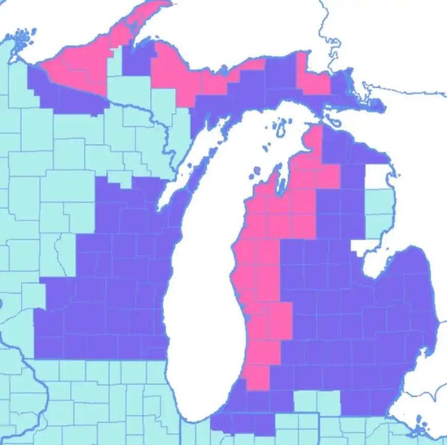
Snowfall and Wind Forecast
Heavy lake-effect snow is anticipated for the western third of lower Michigan. East of Grand Rapids, conditions will include intermittent snow showers. Wind gusts are anticipated to peak at over 35 mph, making travel treacherous.
Expected Snow Accumulation
- Western lower Michigan: Heavy snow likely through Tuesday, with significant accumulation.
- East of U.S. 131: Anticipated snowfall of 2 to 4 inches.
- From U.S. 127 eastward: Forecast indicates 1 to 2 inches.
The blowing and drifting snow may hinder accurate measurements, complicating road conditions.
Wind and Chill Conditions
Winds will generate blizzard-like conditions in western areas, with gusts potentially reaching 50 mph near the Lake Michigan shoreline. The situation will worsen as wind chills plunge dangerously low, reaching between -15 and -25 degrees Fahrenheit.
Driving Warnings
Travel is strongly discouraged, especially on U.S. 31, unless absolutely necessary. Whiteout conditions are likely throughout the day due to the dry snow and strong winds. Conditions will improve slightly tonight, but strong winds will continue to hamper visibility and safety.
Important Updates
Residents are urged to stay informed about changing weather conditions. For latest updates, tune into local weather forecasts and updates on Filmogaz.com.


