


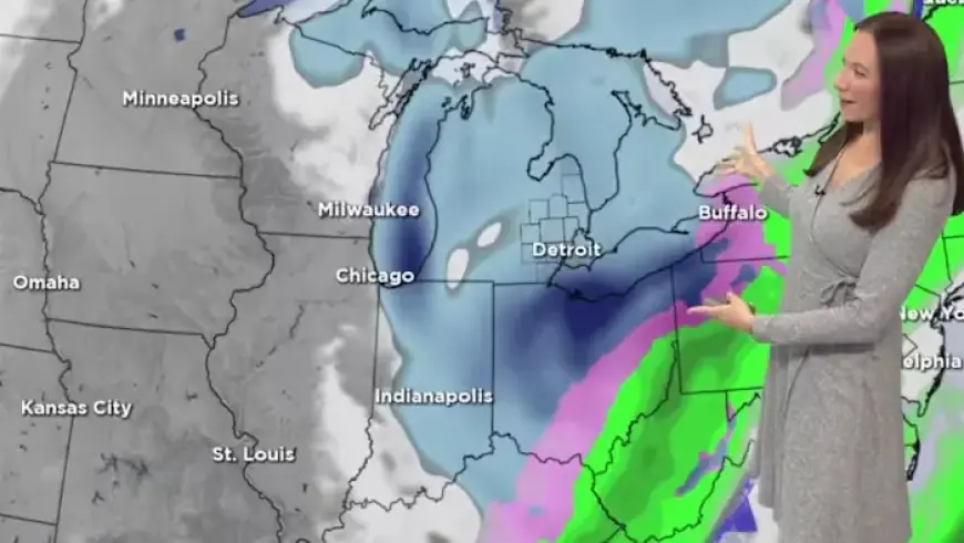
Metro Detroit Snow Forecast: Accumulation Totals and End Time Revealed
Snow has made its presence felt in Metro Detroit, starting Wednesday morning. The wintry precipitation transitioned from rain to snow in the late morning hours, affecting the entire Southeast Michigan region.
Metro Detroit Snow Forecast: Accumulation Totals and End Time Revealed
As of January 14, 2026, temperatures hover in the mid-20s. Northwest winds are blowing at speeds of 10-15 mph, bringing wind chills down to around 20 degrees.
Snow Accumulation Predictions
The latest forecast updates have increased expected snowfall totals significantly. Residents can anticipate an additional:
- 1 to 2 inches of snow on top of the 1 to 3 inches already accumulated.
- Higher totals may reach up to 6 inches in areas like the Thumb region and near Lake Huron due to the lake effect.
Winter Weather Advisory Details
A Winter Weather Advisory remains in effect for most of Southeast Michigan until 10 p.m. on Wednesday. However, for Sanilac County, this advisory will conclude at 10 a.m. on Thursday.
Road Conditions and Safety Precautions
Drivers should exercise caution on untreated roads, which are expected to be slick. Snowfall is anticipated to cease by Wednesday night for most areas. However, lake effect snow will persist in the Thumb region.
Upcoming Weather Changes
Overnight temperatures will drop to around 10 degrees, with wind chills potentially falling at or below zero by Thursday morning. Residents can expect a brief respite with sunshine on Thursday, but snow chances will return on Friday.


