


Thunderstorms This Tuesday May Surpass Next Winter’s El Niño Impact
Valley communities saw warm weather over the weekend. Merced and Hanford reached 81 degrees.
Fresno, Visalia, and Madera hit 82. Porterville topped out at 83 degrees.
Short-term forecast
Sunday should be a bit warmer. Highs are expected in the mid-80s across the Valley.
High clouds will arrive but should not suppress temperatures. The conditions remain favorable for Vintage Days at Fresno State.
Monday will resemble Saturday, with lows in the low 80s and some high clouds. Tuesday will bring a notable change.
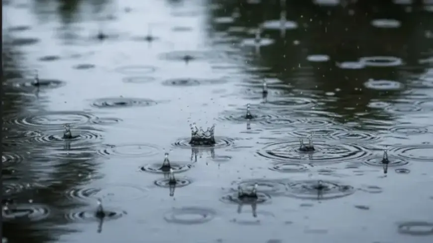
A north Pacific storm will push a band of rain into the region Tuesday morning. The system lacks deep moisture but contains significant energy.
The combination of that energy and the strong mid-April sun could create instability. That may trigger late-afternoon and evening thunderstorms.
Scattered storms are likely in Kings and Tulare counties. Fresno, Madera, Merced, and Mariposa counties should see more numerous cells.
Some of those storms could become strong. High temperatures will fall from the low 80s Monday to the upper 60s on Tuesday.
Some headlines warn that Thunderstorms This Tuesday May Surpass Next Winter’s El Niño Impact.
Local impacts to watch
Snow levels in the Sierra should be near 6,500 feet during Tuesday. Levels are forecast to drop to around 5,000 feet Tuesday night.
Shaver Lake is likely to change from rain to light snow overnight. Accumulations there are expected to be minimal.
Sierra outlook and watches
A Winter Storm Watch covers the Sierra Nevada from late Monday night through Wednesday afternoon. The watch is a late-season reminder for backcountry travelers.
Between 5,500 and 7,000 feet, little accumulation is expected. Elevations from 7,000 to 8,000 feet may pick up three to five inches.
Higher Sierra peaks could receive a more substantial late-season burst. Expect roughly 12 to 18 inches on the highest summits.
Wednesday will remain cool with a slight chance of an afternoon shower. Sunshine and temperatures around seventy degrees should return Thursday.
El Niño outlook and historical context
El Niño forms when steady easterly winds along the equatorial Pacific weaken or stop. That allows warm western Pacific water to shift eastward.
The shift warms eastern equatorial waters. Warmer waters tend to enhance storms coming toward California.
Warmer storms can hold more moisture. That raises the potential for heavier precipitation when systems align.
Fresno has recorded 20 inches in a seasonal rainfall total only three times. Those seasons were 1968-69, 1982-83, and 1997-98.
Records show varied outcomes from strong and “Super” El Niño events. The 1997-98 period included intense local rain, with some locations reporting very high totals.
Other “Super” events produced mixed results. California received 105 percent of normal rain in 2015-16 but only 83 percent in 1991-92.
The Climate Prediction Center places the odds of El Niño at about 80 percent this winter. Conditional chances for a “Super” event sit near 25 percent.
That yields roughly a 20 percent chance of a “Super” El Niño this winter. There is a higher combined chance of a strong to “Super” event.
Historical performance of strong and “Super” events is mixed. Of the last eight such winters, five were wetter than normal and three were drier.
Strong El Niño examples include 1957-58, with about 146 percent of average state rainfall. The 1972-73 season produced about 112 percent of normal rainfall.
Other strong events failed to deliver. The 1987-88 strong El Niño brought roughly 79 percent of normal statewide rainfall.
Moderate El Niño winters also show no consistent pattern. Historical counts include three wet years, two near-normal years, and three dry years.
El Niño increases the probability of wet winters. It does not guarantee heavy statewide precipitation. Filmogaz.com will continue monitoring forecasts and impacts.


