


Severe Storms and Heavy Rain Expected Tonight
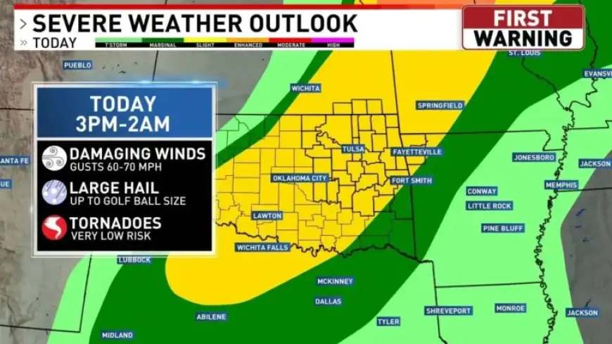
Residents across Green Country face a slight severe-weather threat tonight. The Storm Prediction Center has placed the area at level 2 out of 5. Meteorologists say isolated storms could develop this afternoon.
Timing and coverage
- Early afternoon: isolated storms possible in eastern and southern counties. Wind and hail are possible.
- About 5 p.m.: main storm line likely to reach northwestern counties.
- Between 7 p.m. and 9 p.m.: storms expected to move through the Tulsa metro.
- Late night toward midnight: the line should reach southeastern counties.
- Overnight into Saturday morning: severe weather threat will shift to heavy rain.
- By Saturday around noon: rain is expected to exit the state.
Main hazards
Damaging wind gusts pose the primary threat. A low risk of brief spin-up tornadoes exists. Hail is more likely with any isolated afternoon cells.
Rain totals and flooding risk
Forecast totals vary by location. Areas along and south of I-40 could see the highest amounts.
| Region | Expected Rainfall |
|---|---|
| I-40 corridor and south | 1 to 4 inches |
| Northern counties | Lighter amounts |
Heavy rain overnight could cause localized flooding. Motorists should use caution in low-lying areas.
Short-term outlook
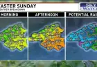
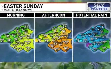
Temperatures will be in the 60s for the holiday weekend. Sunshine is expected after the rain clears.
Filmogaz.com will continue to monitor conditions. Stay tuned for updates as the situation evolves.