


Minnesota Snow Threat Spurs Travel Warnings as Cross-Country Storm Brings More Extremes
Travel is not advised in parts of southern minnesota as a major storm system pushes dangerous winter weather across the region, with another 6 to 10 inches of snow likely in the Twin Cities. The same cross-country storm is also raising the threat of a severe thunderstorm outbreak elsewhere this weekend, highlighting a volatile mix of hazards across multiple U. S. regions.
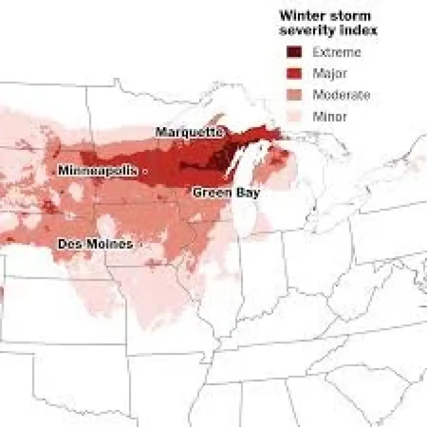
Travel Advisories Expand Across Southern Minnesota
The most immediate concern in minnesota is the travel warning affecting parts of the state’s southern areas. The advisory signals conditions that can make driving difficult or unsafe, as the storm’s impacts spread and intensify. While the affected locations were not fully detailed, the warning underscores that conditions have deteriorated enough for officials and forecasters to urge people to avoid travel in certain areas.
At the same time, the Twin Cities are bracing for additional accumulation, with 6 to 10 inches of snow likely. That forecast points to disruptions that often follow significant snowfall, including reduced visibility and hazardous road conditions, even for routine commutes. With the system still active, the risk picture can change quickly as heavier bands set up and shift.
Twin Cities Could See Another 6 to 10 Inches
The Twin Cities forecast for another 6 to 10 inches is a central marker of the storm’s potential impact in the state. Such totals can strain travel across major roads and neighborhood streets alike, complicating plans and increasing the likelihood of delays. The forecast also raises concerns about how long difficult conditions may persist, particularly if snowfall rates increase during peak travel periods.
Because the storm is part of a broader system affecting large portions of the country, the heavy snow expected in the metro area is not an isolated event. Instead, it is one element of an expansive weather pattern producing different threats in different places at the same time.
A Powerhouse Cross-Country Storm Brings Multiple Hazards
Beyond the Upper Midwest, the storm is described as a powerhouse system spanning the country, combining heavy snow in some areas with the threat of a severe thunderstorm outbreak in others. That split personality—winter conditions on one side of the system and potentially dangerous convective weather on another—illustrates how a single storm can create sharply different risks across the U. S.
The severe thunderstorm threat adds another layer of complexity for weekend plans nationally. While the storm’s thunderstorm impacts were not specified by location in the available information, the warning that an outbreak is possible points to a heightened level of concern in areas prone to severe weather as the system advances.
In addition, a separate weekend outlook flags that 11 cities could see heavy snow or severe thunderstorms. The inclusion of multiple cities in the risk outlook reinforces the wide geographic footprint of the system and suggests that impacts may not be limited to a single corridor.
What Residents Should Watch as Conditions Shift
With travel not advised in parts of southern Minnesota and more snow likely for the Twin Cities, the near-term focus is on how quickly conditions worsen and where the most intense snowfall sets up. The same is true nationwide, where severe thunderstorm potential depends on how the broader storm evolves. As the weekend unfolds, the key developments will be any changes to the travel advisories and whether snowfall projections for the Twin Cities shift upward or downward as the storm’s track and intensity become clearer.
For now, the latest outlook paints a clear picture: parts of Minnesota face significant winter hazards, while other areas of the U. S. confront a heightened risk of severe thunderstorms—two very different threats tied to one far-reaching storm system.


