


Nebraska Fires: Lancaster County containment contrasts with Dawson County evacuations
Thursday’s nebraska fires produced two very different operating pictures: grass fires in southwest Lancaster County that moved toward containment and lifted evacuation orders, and a brush fire in southwest Dawson County that prompted expanding evacuations and highway closures. Placing the two side by side answers a practical question: when crews face multiple ignitions on the same day, what marks the shift from stabilization to escalation?
Lancaster County Sheriff’s Office: evacuations lifted as fires become mostly contained
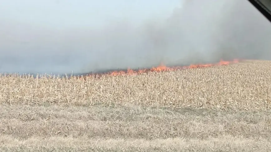
In southwest Lancaster County, firefighters worked several grass fires through the afternoon. Crews were battling two grass fires just northwest and southwest of Denton, plus a third fire east of Crete at about 1: 50 p. m. Additional grass fires also broke out elsewhere in the county as the day continued, keeping responders moving across multiple sites rather than concentrating on a single perimeter.
Even with new starts still appearing, the Lancaster County Sheriff’s Office gave a status update at 5: 50 p. m. that framed the situation as trending toward control: a few grass fires were still “popping up, ” but everything was “mostly contained. ” That containment picture was paired with concrete changes for residents. A fire near SW 112th and W Pioneers was contained around 2: 20 p. m., and the evacuation order for that area was lifted. Another evacuation order covering SW 100th and Wittstruck and SW 84th and Wittstruck was lifted just before 6 p. m.; the fire there was contained, while crews continued working in the area.
Transport restrictions also eased in a nearby county as conditions improved. Highway 77 in Gage County had been closed in both directions from West Hickory Road to West Pickrell Road because of a grass fire, but by 4: 16 p. m. the highway reopened. The Gage County Sheriff’s Office said firefighters were battling the fire with high winds and smoke, a reminder that even as Lancaster County lifted evacuation orders, wind remained an operational factor in the wider region.
Dawson County and Highway 47: evacuations and closures as wind shift threatens Farnam
Southwest Dawson County presented the opposite trajectory. Crews continued to battle a brush fire that started south of Maxwell on Thursday, and the response posture emphasized movement away from danger rather than returning home. Mutual aid came from as far away as Lexington, Cozad, and Arnold, reflecting a larger footprint of support as the incident developed.
An evacuation order was issued for several areas: the Village of Farnam, the Jeffrey Lake area, all houses 2–3 miles south of Gothenburg, and locations south of Tri City and east of Highway 47. Road access also narrowed. Highway 47 was closed in both directions from the Gothenburg interchange to Highway 23, and the public was asked to avoid the area and use alternate routes while emergency personnel managed the situation.
A key difference in the Dawson County fire was the explicit forecast-driven warning. The National Weather Service said the wildfire in southwest Dawson County was expected to turn south with a wind shift at 10: 00 p. m. ET and threaten Farnam. Shelter guidance followed that threat assessment: evacuees in the Farnam area were advised to go to Eustis Public Schools, and Brady School at 112 E Popleton Ave in Brady was also set to open with food, water, blankets, and beds. Gothenburg Schools was not open as a shelter at that time.
Nebraska Fires compared: what “lifted orders” vs. “new evacuations” reveals
Viewed together, the two situations show how quickly nebraska fires can diverge in public impact, even on the same Thursday and under wind-influenced conditions. Lancaster County’s messaging centered on containment milestones and the step-by-step lifting of evacuation orders; Dawson County’s messaging centered on expanding evacuation geography, a major highway closure, and shelter destinations tied to a specific expected wind shift at 10: 00 p. m. ET.
| Comparison point | Southwest Lancaster County | Southwest Dawson County |
|---|---|---|
| Fire type described | Multiple grass fires | Brush fire south of Maxwell |
| Public safety posture | Evacuation orders lifted in specific areas | Evacuation order issued for multiple areas |
| Road impacts | Highway 77 in Gage County reopened at 4: 16 p. m. ET | Highway 47 closed from Gothenburg interchange to Highway 23 |
| Operational signal | At 5: 50 p. m. ET, “mostly contained, ” with some new starts | Expected wind shift at 10: 00 p. m. ET threatens Farnam |
| Resident guidance | Avoid affected areas; follow firefighter and law enforcement instructions | Avoid area; use alternate routes; go to designated shelters |
Analysis: The clearest dividing line between the two responses is not simply the number of locations mentioned, but the direction of official action. In Lancaster County, authorities moved from restricting movement to restoring it, lifting evacuations and noting containment even as a few new grass fires appeared. In Dawson County, authorities moved in the other direction, widening the evacuation map and anchoring the warning to an expected wind-driven shift that could push the fire toward Farnam.
The comparison establishes a straightforward finding: on this day, Lancaster County’s fires reached a phase where officials could unwind evacuations, while Dawson County’s fire remained in a phase where forecast conditions and road closures required pushing more people out of the threatened area. The next confirmed test of that finding is the National Weather Service’s expected 10: 00 p. m. ET wind shift; if the wind shift maintains the projected turn south, the comparison suggests Dawson County’s shelter and evacuation planning will remain the primary public-safety focus even as Lancaster County continues post-containment work.


