


Severe Tornado Warning: Baseball-Sized Hail and 75 mph Gusts Expected
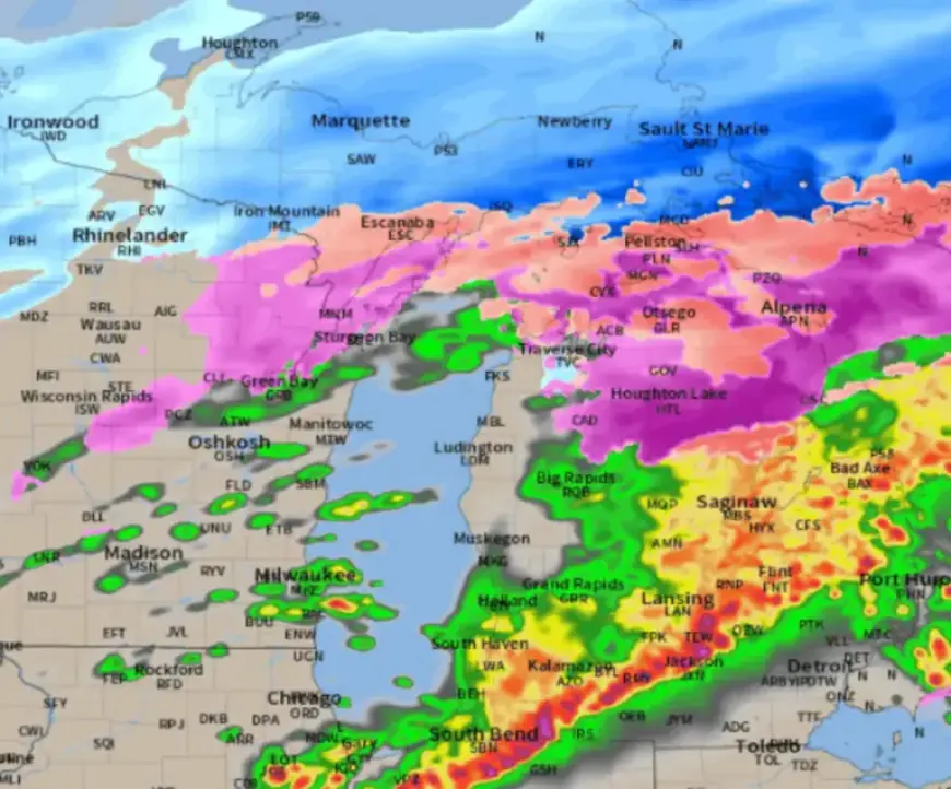
A severe tornado watch is currently in effect for parts of far southwest Michigan. Additionally, a severe thunderstorm watch extends from Iowa into Michigan, with expectations of intense thunderstorms. These weather conditions may produce tornadoes, large hail, and high winds.
Tornado Watch Details
The tornado watch includes four counties along the Indiana border: Berrien, Branch, Cass, and St. Joseph. The cities affected are:
- Benton Harbor
- Bronson
- Buchanan
- Cassopolis
- Coldwater
- Dowagiac
- Edwardsburg
- Fair Plain
- Marcellus
- Mendon
- Niles
- Paw Paw Lake
- St. Joseph
- Sturgis
- Three Rivers
- Union City
- White Pigeon
This watch is set to remain in effect until 2 a.m. Eastern Time.
Severe Thunderstorm Watch
A severe thunderstorm watch is active for seven counties in southwest and west-central Lower Michigan. The included counties are:
- Allegan
- Barry
- Kalamazoo
- Kent
- Muskegon
- Ottawa
- Van Buren
Major cities within this area include Grand Rapids, Kalamazoo, and Holland. This watch is in effect until 1 a.m.
Potential Hazards
The Storm Prediction Center has indicated that hail could reach sizes of up to three inches, comparable to baseballs. Such large hail poses a significant risk of damage to vehicles and structures. Residents are advised to park cars in garages or sturdy structures.
The Timing of Severe Weather
Severe thunderstorms are expected to intensify during the evening hours, particularly from 8 p.m. to 10 p.m. The unique timing is due to a powerful jet core entering the region. This weather pattern may lead to “elevated thunderstorms,” which can occur even in cooler temperatures.
Safety Precautions
While elevated thunderstorms may decrease the likelihood of tornado formation, they still present risks. The potential for EF2 or EF3 tornadoes exists in areas south of I-94, particularly in southwest Lower Michigan.
If severe thunderstorms approach, residents should seek shelter in basements or interior spaces of their homes. Stay updated with live severe weather coverage as needed, and monitor local news outlets for the latest information on these severe conditions.


