


Weather Montreal: Freezing Rain Threat Could Knock Out Power and Disrupt Travel
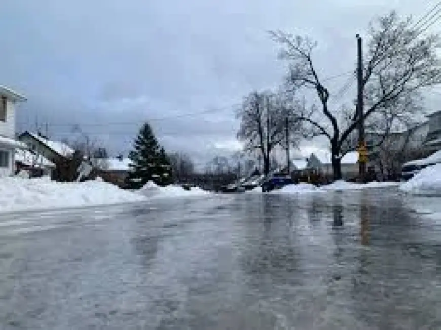
Thursday at 9: 00 a. m. ET, Montreal residents face a growing chance of freezing rain that could cause tree damage, power outages and hazardous travel, Environment Canada warns. The immediate impact is expected as a messy storm pushes into Ontario and southern Quebec, bringing a wintry mix and a separate weekend rain threat.
Montreal residents face tree damage, power outages and travel risks
Montreal and nearby communities are the groups most likely to see direct effects: some areas may receive a significant amount of freezing rain, which can accumulate on branches and power lines and create dangerous road conditions beginning in the overnight hours. Ottawa and Montreal are singled out as cities that should pay particularly close attention as the event develops.
Environment Canada outlines storm mechanics that raise freezing-rain risk
A large centre of low pressure over the Mississippi Valley will slowly slice across southern and eastern Ontario through late Wednesday, pushing precipitation into the region. Precipitation is expected to build into Ontario beginning Tuesday night, with showers spreading across most of southern Ontario and a slight risk for thunderstorms in the extreme southwest. In central parts of the province a wintry mix will develop and extend east across cottage country into eastern Ontario, while warm air aloft crossing paths with a stubborn slab of subfreezing air at the surface will increase the potential for freezing rain across southern Quebec into Wednesday.
Weather Montreal: Saturday forecast of rain, gusty winds and mild temperatures
For weather montreal on Saturday, Environment Canada is forecasting periods of rain totaling about 5 to 10 mm with a daytime high of 11. Southeast winds at 20 km/h, gusting to 40, are expected to become southwest at 20, gusting to 40 near noon. Overnight periods of rain are forecast to drop about 10 mm with a southwest wind at 30 km/h, gusting to 50, and a low of plus 3.
Still, the midweek storm and the weekend rain are separate concerns: the midweek system carries the freezing-rain and ice-storm potential that threatens infrastructure and travel, while the Saturday forecast signals milder, rainier conditions and gusty winds that could complicate cleanup or travel plans.
Wind conditions behind the midweek cold front are expected to increase across the region; gusts of 40–60 km/h are forecast through Thursday in southern Ontario, which will make conditions feel colder and could worsen hazards on exposed routes should freezing precipitation occur.
That said, forecasters caution that timing and exact precipitation types will vary across short distances as warm air aloft overrides surface cold air, creating a sharp temperature gradient across the region. In southern Ontario, for example, easterly lake winds may keep some areas in single-digit temperatures while nearby Windsor approaches 20°C before a rapid drop behind the front.
If the cold front passes through as described, the freezing-rain threat is expected to dissipate across eastern Ontario after the front moves through; officials and residents should monitor updates and prepare for possible tree and power impacts in the near term.


