Satellites Reveal Vulnerable Bridges Across the Globe
Recent advancements in satellite technology are enabling scientists to assess the vulnerability of bridges worldwide. This innovative approach aims to identify which structures are at risk and how to address potential failures before they lead to disasters.
Reducing Risk with Satellite Monitoring
The integration of satellite monitoring with traditional bridge inspections has proven effective. Studies show that this combination can lower the number of bridges categorized as high-risk by nearly one-third. Among those identified as high-risk, approximately 50% could benefit significantly from ongoing satellite observations.
Global Analysis of Bridge Conditions
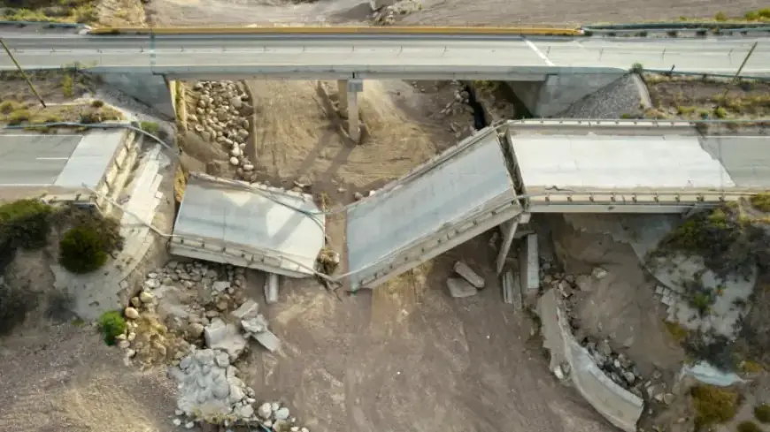
A research team led by Pietro Milillo from the University of Houston conducted a comprehensive evaluation of 744 bridges, a study published in Nature Communications. Their findings revealed that North American bridges are in the poorest condition, followed closely by those in Africa.
Aging Infrastructure Concerns
Many bridges analyzed are nearing the end of their intended lifespan. The construction boom of the 1960s in North America has left numerous bridges aging and exceeding their original design life.
Innovative Space-Based Monitoring Solutions
To tackle these challenges, researchers are utilizing Synthetic Aperture Radar (SAR) technologies. This method captures high-resolution images frequently and offers extensive historical data access. Milillo noted that satellite radar monitoring could provide regular oversight for over 60% of the world’s long-span bridges.
Detecting Shifts with Multi-Temporal Interferometric SAR
The team also employed Multi-Temporal Interferometric Synthetic Aperture Radar (MT-InSAR), which can identify minute structural shifts due to geological processes or emerging issues. This remote sensing method can detect movements as small as a few millimeters, offering vital data that supplements traditional bridge inspections.
Challenges in Current Bridge Monitoring
Bridges are critical components of transportation infrastructure, yet existing monitoring strategies have significant limitations. Traditional inspections are often subjective and infrequent, typically conducted only twice a year. Structural Health Monitoring (SHM) systems, while effective, are seldom deployed on older or less monitored bridges, with less than 20% of long-span bridges currently equipped with these sensors.
The Case for Remote Sensing
- Remote sensing complements SHM systems and can lower maintenance costs.
- MT-InSAR provides frequent deformation measurements across entire bridge networks.
- This method has yet to be widely adopted despite its established efficacy in academic research.
Improving Accuracy in Risk Evaluations
Incorporating MT-InSAR data enhances the accuracy of bridge risk assessments. The technique uses stable radar reflections from satellite pixels known as persistent scatterers to reduce uncertainty. This integration allows engineers to prioritize maintenance efforts more effectively.
Integrating Data for Better Decision Making
The research team advocates for the combined use of SHM data and satellite observations from missions like the European Space Agency’s Sentinel-1 and NASA’s NISAR. This fusion of information enables authorities to receive more frequent updates, offering a clearer picture of the condition of bridges and informing maintenance strategies.
By harnessing advanced satellite monitoring technologies, experts can mitigate risks associated with aging infrastructure and improve the overall safety of global bridge networks.