


Winter Storm Watch: New Forecasts Point to 5–12 Inches for NYC Area as Nor'easter Approaches
A winter storm watch has entered forecasts as a coastal nor'easter is expected to affect the East Coast over the coming weekend. New guidance calls for significant snowfall across the New York City area, elevating the potential for disruption into Sunday and Monday.
Winter Storm Watch — Development details
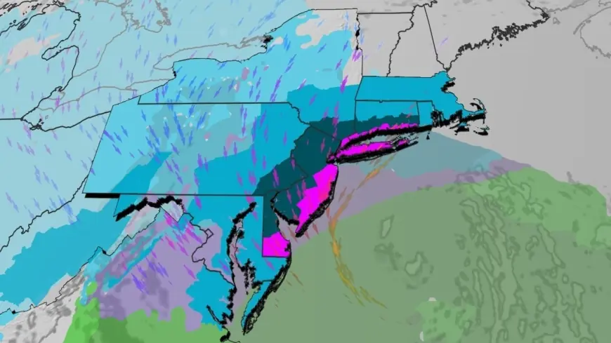
Forecasters now signal a coastal nor'easter developing over the weekend, with the most recent outlooks projecting 5 to 12 inches of snow across the New York City area. Separate forecasts for New York City and New Jersey warn of locally higher totals, with up to 10 inches highlighted specifically for Sunday. The storm system is expected to influence the region beginning Sunday and persist into Monday.
Context and escalation
The current forecast represents an escalation from earlier expectations for a weekend coastal system. The characterization of the event as a nor'easter reflects an onshore track that typically brings widespread precipitation to the East Coast. What makes this notable is the clustering of forecasts around a mid-range snowfall scenario—multiple outlooks converging on roughly the same window of 5 to 12 inches for the metro area—tightening the margin for planning by officials and residents.
Immediate impact
Immediate effects will be driven by the timing and intensity of snowfall beginning Sunday. With guidance calling for up to 10 inches in parts of New York City and New Jersey on Sunday alone, the most direct impacts will fall on urban and suburban travel, outdoor operations and any weekend plans. The confluence of measurable snowfall totals—5–12 inches across the wider NYC area—and a multi-day storm window through Monday increases the likelihood of sustained snow coverage on streets and transit corridors.
Forward outlook
Attention now turns to the progression of the system through Sunday into Monday and to any further refinements in expected totals and timing. Forecasting agencies are updating guidance as the event draws nearer; residents and institutions in the NYC and New Jersey region should monitor the evolving outlook. The next decisive milestones will be updated short-range model runs and official briefings as the weekend approaches, which will narrow the expected accumulation ranges and timing.
The appearance of the phrase winter storm watch in the current messaging underscores that forecasters are treating this as a potentially impactful snow event rather than an isolated shower system. Authorities have highlighted the Sunday–Monday window and snowfall amounts as the primary metrics for preparedness in the coming days.