


Hilton Head Braces for Extreme Cold Following Snowstorm: Forecast Update
Residents of Hilton Head Island are bracing for extremely cold weather following a recent snowstorm. The National Weather Service (NWS) has issued an extreme cold warning effective until 1 p.m. on Sunday, February 1.
Weather Forecast and Conditions
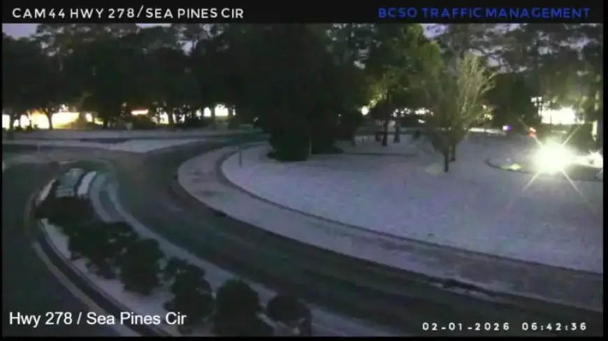
According to the NWS’s 5 a.m. update, temperatures in the Beaufort area could drop to as low as 21 degrees. Additionally, wind chill could make it feel as cold as 6 degrees. A winter weather advisory is also in effect until 10 a.m. Sunday due to hazardous travel conditions.
Potential Hazards
- Black ice formation on untreated surfaces.
- Hazardous travel conditions due to winter weather.
Later in the day, temperatures are expected to reach a high of 36 degrees, with winds gradually diminishing. Sunny skies are predicted, which should aid in melting the snow.
Looking Ahead: Sunday Night and Monday
On Sunday night, temperatures will be slightly warmer than those in the morning. However, black ice remains a risk on untreated surfaces into both Sunday and Monday nights.
Monday’s Weather Update
Monday will bring sunny conditions that will support further melting of the remaining snow. The forecast predicts a high of 44 degrees. Nonetheless, the early morning temperatures could sink to 25 degrees. Wind chill might make it feel as cold as 18 degrees.
Residents should remain cautious during this frigid period, especially regarding black ice on the roads and sidewalks.