


Charlotte Prepares for Incoming Snow: Forecast and Timing Revealed
Charlotte is set to experience a significant winter storm beginning Friday night. The storm is expected to last through Saturday night, bringing snow and extreme cold temperatures.
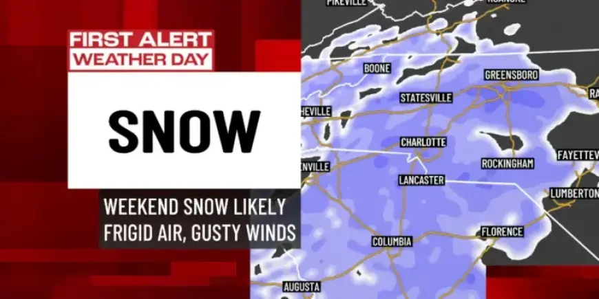
Snow Forecast for Charlotte
Snow will begin in the mountainous regions Friday afternoon, before moving into Charlotte and the Piedmont late Friday night into Saturday morning. The heaviest snowfall will occur Saturday morning and into early afternoon.
Snow totals for Charlotte are projected to be between 3 to 6 inches, with higher amounts possible along Interstate 85. The mountains may see 4 to 8 inches, with localized areas experiencing even greater accumulation.
Timing and Effects of the Storm
- Snow expected to start Friday night.
- Heaviest accumulation projected for Saturday morning.
- Snow will taper off Saturday evening.
- By Sunday morning, snow will have dissipated, but cold temperatures will remain.
Factors Behind the Snow
This storm results from a complex weather setup involving a strong polar upper-level low moving south into the Mississippi Valley. This pattern allows for enhanced snow production.
A coastal low developing along the Carolina coast plays a key role. Charlotte benefits from the geographical positioning that pulls in both moisture from the Atlantic and cold air, creating ideal conditions for snow.
Possible Variations in Snow Accumulation
- Increased Snowfall: If the upper-level low tracks correctly over the Southern Appalachians or if localized snow bands develop.
- Decreased Snowfall: If the coastal low moves too far offshore or if a “dry slot” occurs between snow bands.
Extreme Cold Following the Snow
In addition to snow, Charlotte and surrounding areas will face severe cold. Saturday’s high temperatures are expected to peak in the mid-20s, while mountain areas may experience single-digit highs.
Saturday night lows could drop to negative digits in the mountains and low teens in Charlotte. Wind chills may make it feel even colder, particularly in mountainous regions.
Safety Precautions
An Extreme Cold Watch is in effect across the region. It is vital to take precautions to ensure safety during this hazardous weather period:
- Dress warmly to protect against cold temperatures.
- Check on family members who may need assistance.
- Exercise caution while traveling, as road conditions may be slick.
Preparedness Recommendations
Residents should prepare for possible power outages, although widespread outages are not expected. Stay informed, as snow totals and conditions may evolve. Regular updates should be monitored leading into Friday and Saturday.
This storm presents a rare winter weather event for the Carolinas, combining significant snowfall with extremely low temperatures, making preparedness essential.