


Bomb Cyclone Predicted Off East Coast: Weekend Scenarios Explained
Confidence is rising regarding the formation of a powerful winter storm off the East Coast this weekend. This winter storm is anticipated to develop amid dangerously low temperatures, potentially classifying it as a bomb cyclone. Predictions about its path, strength, and snowfall impacts remain uncertain.
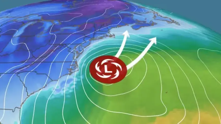
Storm Formation and Prediction Timeline
As of Tuesday morning, weather models indicate that a storm will emerge off the Carolinas by early Saturday. The models currently agree that it will intensify quickly. However, the exact trajectory of this storm remains unclear.
A minor shift of 100 to 200 miles in its projected path could significantly alter snowfall amounts for major cities along the East Coast. Meteorologists expect a clearer picture later in the week as confidence increases.
Possible Scenarios for the Weekend
Three primary scenarios have been identified regarding the potential impacts of the storm:
- Coastal Impact Scenario:
The most likely scenario at this time suggests that the storm will graze the East Coast. It is expected to bring snowfall and other impacts mainly to coastal areas from Cape Hatteras, North Carolina, to Cape Cod, Massachusetts. Heavy snow and strong winds will hit eastern North Carolina, with significant coastal erosion possible. - Heightened Snowfall Scenario:
If the storm shifts slightly westward, it could affect cities along the I-95 corridor, from Washington, D.C., to Boston, dumping potentially feet of snow. Some forecasts show this scenario with a comparable probability to the coastal impact scenario. - Offshore Scenario:
In the final scenario, the storm moves further offshore, sparing the Carolinas and other areas from significant impacts. Strongest winds and snowfall would remain at sea, resulting in minimal local disruptions.
Intensity and Safety Considerations
This impending storm is expected to be distinct from the previous winter storm that affected the eastern United States. Despite its potential intensity, this storm will have a more targeted impact along the coastline. Freezing rain and sleet appear unlikely due to the cold air preceding it, which is a favorable shift for areas recently affected by ice.
Nevertheless, hazardous conditions are possible, including blizzard conditions due to strong winds and damaging waves impacting the eastern coastline.
Stay Informed
Residents from the Carolinas to the Northeast should stay updated with the latest forecasts leading up to the weekend. A significant winter storm is becoming increasingly likely, and preparedness is essential to mitigate its potential impact.