Extreme Cold Warning in Austin: Road Conditions Remain Icy, Refreeze Risk Persists Through Midday Monday
Austin woke up Monday, January 26, 2026 to a dangerous mix of bitter air and lingering ice, with an Extreme Cold Warning in effect and travel officials urging people to stay off the roads if possible. Even where streets look “wet” rather than frozen, the bigger threat is black ice—thin, nearly invisible glazing that can turn bridges, overpasses, hills, and shaded lanes into crash zones in seconds.
As of this morning, Austin’s temperature was around 22°F, with a daytime high near 38°F and another freezing night expected—conditions that encourage melting-and-refreezing cycles that keep roads unpredictable.
What the Extreme Cold Warning means for Austin in practical terms
The warning is set to run until 1:00 PM ET Monday across the Austin area. Wind chills have been projected to drop into the single digits to teens for much of the region, with even colder wind chills possible in surrounding higher-elevation areas.
That matters because:
-
Wind chill speeds up frostbite risk on exposed skin.
-
Pipes and outdoor plumbing are more likely to freeze or burst.
-
Road treatment loses effectiveness when temperatures stay very low, especially overnight.
Austin road conditions: where the biggest hazards are right now
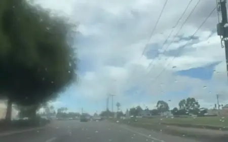
While widespread wintry precipitation has tapered off, ice and sleet residue has lingered on major routes and can persist in patches even after crews treat primary corridors. Areas repeatedly flagged as higher-risk include:
-
Bridges, overpasses, and elevated ramps (they freeze first and thaw last)
-
MoPac and other fast-moving north–south corridors where shaded stretches can hold ice
-
State Highway 45 segments where cameras have shown lingering coating
-
Hillier West Austin routes where grade changes amplify loss of traction
-
Neighborhood side streets that may not be treated, especially cul-de-sacs and shaded lanes
The key point: “passable” does not mean safe. A single untreated patch can cause multi-car pileups, especially if traffic speeds stay normal.
What’s new and why now: the refreeze trap
Today’s headline isn’t just “it’s cold.” It’s the refreeze trap: any melting late morning or midday can turn back into ice after sunset, and even earlier on shaded roads. That’s why officials are emphasizing avoiding travel—not because every road is fully iced, but because conditions can change block-by-block.
This is also why “road conditions Austin” can feel contradictory depending on where you are. One neighborhood may look fine while a nearby overpass is a skating rink.
Behind the headline: why officials keep saying “stay home”
There are strong incentives behind that message:
-
Emergency response bandwidth: Fewer drivers means fewer crashes, and that keeps ambulances and tow trucks available for true emergencies.
-
Crew safety and effectiveness: Road treatment and incident clearance work better when traffic volume is low.
-
System stability: Power lines, trees, and pipes are stressed in hard freezes; preventing avoidable wrecks reduces strain on public services already operating in cold-weather mode.
Stakeholders include commuters, delivery drivers, school districts, healthcare workers, and people without stable heat. When roads get dangerous, the people most exposed are often the ones with the least flexibility.
What we still don’t know (and what to watch)
-
How quickly key bridges and ramps will clear once temperatures climb above freezing in the afternoon
-
Whether shaded corridors stay icy even after the warning expires
-
How extensive overnight refreezing becomes heading into early Tuesday morning
-
Whether localized power issues appear as ice shifts on trees and lines
What happens next: the next 24 hours in Austin, mapped as scenarios
-
Best case: Temperatures rise enough this afternoon for visible improvement on treated roads, and crews clear remaining trouble spots before evening.
-
Most likely: Roads improve unevenly, but refreeze creates fresh hazards overnight, especially on elevated surfaces.
-
Worst case: A thin melt layer forms and then refreezes quickly, producing widespread black ice early Tuesday morning.
-
Operational ripple: More closures or delayed openings continue if overnight conditions worsen.
If you must drive: the safety moves that reduce real risk
-
Treat every bridge and overpass as icy until proven otherwise
-
Drive well below normal speed, especially on ramps and curves
-
Increase following distance dramatically; braking distances can multiply
-
Avoid sudden steering or hard braking—gentle inputs only
-
Keep an emergency kit: warm layers, water, charger, and a blanket
-
If a traffic signal is out, treat it as a four-way stop
Austin’s cold snap is less about a single dramatic snowfall and more about persistent, deceptive ice under extreme temperatures. If you can delay travel until the afternoon warmth settles in—and especially avoid early-morning drives while refreezing is active—you’re not just protecting yourself. You’re helping keep the roads clear for crews and emergency responders when conditions are at their most unforgiving.
