


Snowstorm to Hit Sunday, Disrupting Afternoon Travel Plans
A significant winter storm is approaching Western New York, expected to disrupt travel plans on Sunday. A red alert is currently in effect for Sunday, Sunday night, and Monday due to forecasts predicting heavy snowfall.
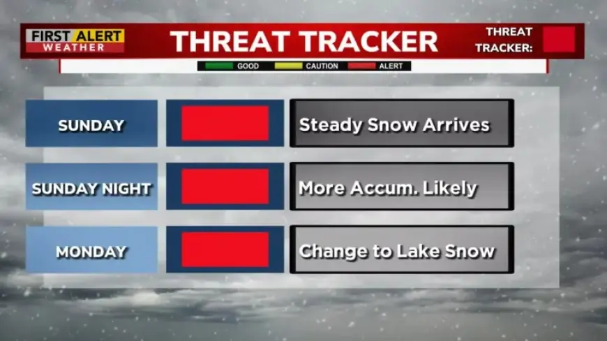
Forecast and Timing of the Snowstorm
Snow is anticipated to begin falling between 8:00 a.m. and 9:00 a.m. on Sunday. As the day progresses, travel conditions are expected to deteriorate significantly by the afternoon. The snowfall accumulation rate will intensify, reaching up to 1.5 inches per hour later in the day.
Snow Accumulation Predictions
By Sunday evening, total snowfall is expected to range between 5 and 9 inches. The storm will continue into Sunday night, with an additional accumulation of 4 to 8 inches likely. At the start of the week, localized lake effect snow may yield another 1 to 2 inches.
- Total snowfall expected: 10 to 18 inches
- Initial snowfall on Sunday: 5 to 9 inches
- Sunday night snowfall: 4 to 8 inches
- Monday potential: 1 to 2 inches
Higher totals are anticipated due to additional moisture coming from Lake Ontario, enhancing the storm’s intensity. Residents are advised to shovel snow in stages to manage the workload effectively, as the snow is predicted to be fluffy.
Travel Recommendations
Travelers should remain cautious and check weather updates frequently. It is essential to stay informed about changing conditions through reliable news sources such as Filmogaz.com.
With the impending storm, preparations are key to minimizing disruption to travel plans and ensuring safety. It is advisable to plan ahead and avoid unnecessary travel during peak storm hours.