N.J. Weather Alert: Snow and Ice Storm Timing & Route Update

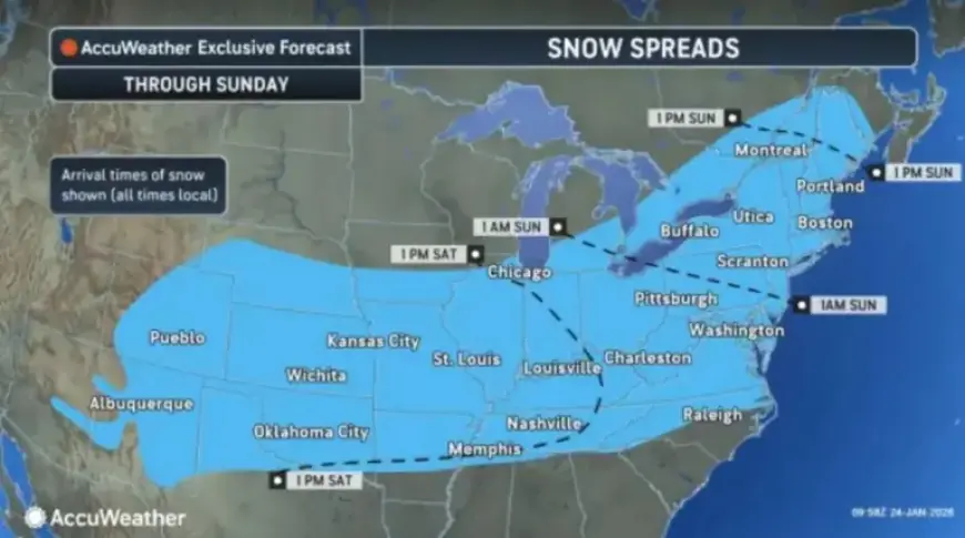
The much-anticipated winter storm is set to hit New Jersey, bringing severe snow and ice conditions starting tonight. According to forecasts, snowfall will commence after 1 a.m. on Sunday, sweeping across the state by dawn. The National Weather Service has classified the incoming system as a major winter storm, projecting significant snow and ice accumulations that could disrupt daily activities.
Snow and Ice Forecast for New Jersey
The storm is expected to deliver heavy snow and a hazardous layer of ice. The latest predictions indicate:
- Up to 18 inches of snow in northern New Jersey.
- Ice accumulation of up to three-tenths of an inch in the southern portion of the state.
- Widespread snow accumulations of 12 to 16 inches likely in northern areas.
Travel conditions are expected to deteriorate quickly. The National Weather Service warns that travel could become nearly impossible. Many flights have already been canceled in anticipation of the storm.
Timing and Transition of the Storm
The storm’s intensity will peak from Sunday morning into early afternoon. Initially, heavy snowfall will occur before transitioning to sleet and freezing rain in various areas. This shift may affect southern New Jersey’s snow projections but does not diminish the overall risks. The combination of snow, sleet, and freezing rain will result in significant impacts throughout the region.
State Emergency Declaration and Travel Bans
Governor Mikie Sherrill has declared a state of emergency, effective from 5 p.m. on Saturday. Residents are urged to remain indoors. A travel ban for commercial vehicles will also be enforced on major highways as safety precautions.
Regional Forecast Details
The National Weather Service has issued winter storm warnings across various counties, providing county-specific forecasts:
| County | Timing | Snow Accumulation | Ice Accumulation |
|---|---|---|---|
| Burlington, Camden, Cumberland, Gloucester, Hunterdon, Mercer, Middlesex, Monmouth, Morris, Ocean, Salem, Somerset | 7 p.m. Saturday – 1 p.m. Monday | 7 to 13 inches | Up to three-tenths of an inch |
| Bergen, Essex, Hudson, Union, eastern Passaic | 3 a.m. Sunday – 6 p.m. Monday | 10 to 14 inches | Light glaze of ice possible |
| Western Passaic | 3 a.m. Sunday – 6 p.m. Monday | 12 to 16 inches | Sleet may mix |
| Atlantic, Cape May | 7 p.m. Saturday – 7 a.m. Monday | 4 to 8 inches | Up to one-tenth of an inch |
| Sussex, Warren | 1 a.m. Saturday – 1 p.m. Monday | 11 to 15 inches | N/A |
Aftermath and Extended Forecast
The storm is expected to taper off by midday Monday, with Arctic air taking hold, leading to very cold temperatures throughout the week. Highs on Monday will struggle to reach the low 30s, with frigid lows predicted in the single digits from Tuesday through Friday.
Residents are advised to stay informed and participate in safety measures during this winter storm event, as the risk of power outages and hazardous road conditions loom significant.


