


Boston snow storm: the weekend setup that can snarl travel, transit, and city services into Monday
Boston’s next snow storm isn’t just a “shovel once and move on” kind of system. The big impact comes from the timing—snow building through Sunday and lingering into Monday—paired with biting cold that can turn plowed streets into re-freezing, rutted pavement and make cleanup slower. That combination matters most for commuters, airport travelers, and anyone counting on predictable public transit or deliveries. Here’s the part that matters: even if your neighborhood totals land on the lower end, the region-wide footprint can still disrupt schedules.
Why this storm hits Boston’s routines first
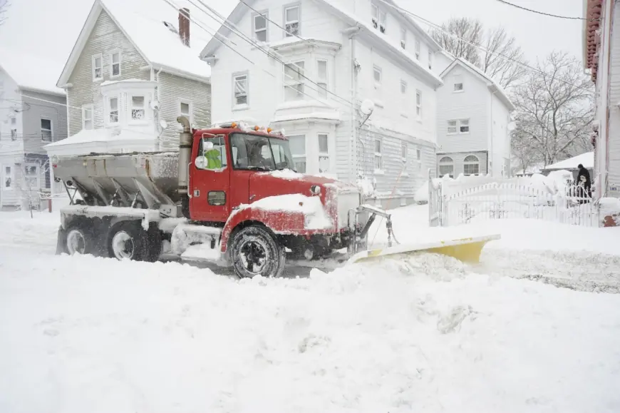
A widespread snow event changes the city’s rhythm long before flakes pile up. Transit agencies typically shift to storm schedules, some bus routes run on snow detours, and certain services can be suspended if accumulation and drifting become an issue. Airports across the Northeast often see knock-on delays when crews and aircraft are repositioned, and airlines preemptively trim schedules to avoid stranded planes and overbooked rebooking queues.
Road conditions can also deteriorate faster than people expect when temperatures stay low. Snow that gets compacted by traffic can harden into slick ridges, and the cold can make salt less effective—meaning the “commute problem” can last longer than the snowfall itself.
It’s easy to overlook, but the most disruptive period is often the transition: when snowfall rates pick up, visibility drops, and plows struggle to keep pace on secondary streets while highways and main arteries take priority.
Mini timeline (local timing may vary by neighborhood):
-
Saturday (Jan 24): Frigid air settles in; wind chills make outdoor prep feel worse than it looks on paper.
-
Sunday (Jan 25): Snow spreads into the Boston area and intensifies at times, especially later in the day.
-
Sunday night into Monday (Jan 26): Heaviest accumulation potential and the highest risk for travel slowdowns.
-
Monday: Snow tapers, but cleanup and re-freezing can keep roads and sidewalks rough well after the last flakes.
The real test will be how quickly conditions improve Monday morning—because that depends as much on snowfall rates and temperatures as it does on plow progress.
What’s known so far about snowfall, cold, and the trouble spots
Forecast signals point to a significant snow event for Massachusetts and much of New England, with Boston in the zone for substantial accumulation and some nearby areas potentially higher. Parts of the region are under winter storm alerts, and guidance supports at least a foot in many communities, with pockets that could push into the 1–2 foot range if the storm track and coastal redevelopment favor heavier bands.
A few practical takeaways for Boston and surrounding towns:
-
Boston proper: A solid, city-disrupting snowfall is on the table—enough to slow roads, strain parking, and complicate Monday plans.
-
Where totals spike: Heavier bands can set up west and north of the city, and totals can vary sharply over short distances.
-
Cold as a multiplier: Very low temperatures and wind chills raise the risk of icy surfaces and slow cleanup, especially overnight.
-
Transit adjustments: Expect modified service plans on regional rail and buses, and possible suspensions on smaller or more exposed lines if snow piles up quickly.
-
Travel disruptions: Flight cancellations and delays can ripple through Boston-area airports and connecting hubs, especially as the broader East Coast deals with the same system.
If you’re wondering why storms like this feel more disruptive than the totals alone suggest, it’s the overlap: snow during peak travel windows, cold that preserves ice, and a large geographic footprint that stresses staffing and equipment across multiple states at the same time.
As of now, the exact “ceiling” on totals near Boston remains sensitive to storm track and band placement—details that can sharpen quickly as the system arrives. The safest assumption for planning is that Sunday into early Monday is the period most likely to break routines, with Monday cleanup extending the effects even if snowfall is already winding down.


