


Rain and Snow to Hit in Friday’s Winter Storm Update
The region of northeast New Mexico is currently experiencing the effects of an Arctic front, leading to a significant drop in temperatures. Morning temperatures have plummeted into the teens and twenties across the area.
Winter Storm Update: Rain and Snow Expected
As the day progresses, central and northern New Mexico will predominantly see snow due to the advancing colder air. The weather front is set to stall over the central mountain range and continue moving southwards into southeast New Mexico. Accordingly, temperatures will remain chilly, staying just above freezing early in the day.
Current Conditions and Forecast
- Rain is affecting southern New Mexico.
- Snow showers have emerged in western regions, advancing east-northeast throughout the morning.
By Friday night, snowfall and winter weather impacts are expected to become widespread. Winter storm warnings are in effect for the northern and central mountains, along with eastern New Mexico. Some locations may not experience noticeable weather changes until late Friday night or early Saturday.
Saturday’s Weather Hazards
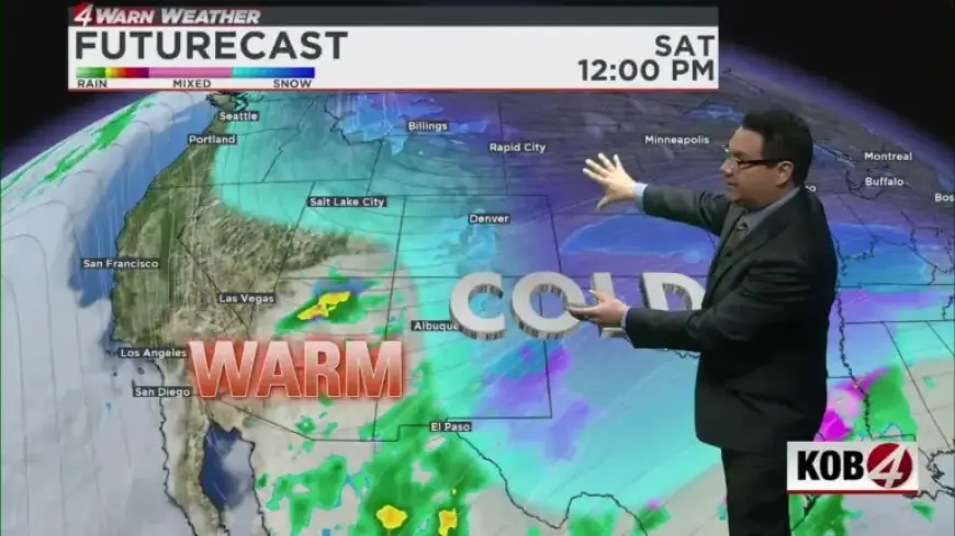
Saturday is anticipated to be a major day for winter weather, as the Arctic air will be firmly established over eastern New Mexico. Snow will persist across central and northern areas, with snowfall levels decreasing during the day.
- By Sunday morning, the western and central parts of New Mexico will face much colder temperatures.
- The eastern regions will remain frigid.
- Precipitation is expected to lessen by late Sunday morning as drier air takes over.
The coldest temperatures are projected for Sunday night into Monday, with some areas dipping into single digits and others potentially reaching below zero. These conditions may create hazardous situations for those lacking adequate heat or shelter.
Weather Timeline for Albuquerque
- Friday Morning: Mostly cloudy with a 10% chance of precipitation.
- Friday Afternoon: Rain chances rise to 40%; temperatures will be in the upper 40s to near 50°F.
- Friday Evening: Rain chances increase to 80-90%; temperatures stay just above freezing.
- Saturday Morning: Rain chances at 80%, with possible flurries for areas near freezing.
- Saturday Afternoon: Rain expected to transition to snow as temperatures drop.
- Saturday Evening: Snow expected to taper off after 9-10 PM.
- Sunday Morning: Snow showers possible with a 20-30% chance.
- Sunday Afternoon: Probability of precipitation decreases.
As the weekend concludes, clear skies are anticipated on Sunday evening, leading to even colder conditions on Monday morning. Residents are advised to prepare for the upcoming cold by remembering the “4 Ps”: People, pets, pipes, and plants.
For further updates and detailed forecasts, stay tuned to Filmogaz.com.