


NYC braces for 10–14 inches as a long-duration snowstorm collides with deep cold
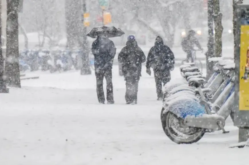
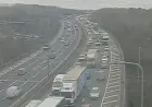
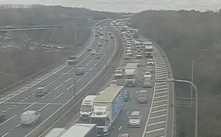
New York City is heading into a high-impact winter weekend where the biggest danger may be the combination: heavy snow arriving in the darkest hours, then lingering into the workweek while temperatures stay well below freezing. Forecasts for the five boroughs call for 10 to 14 inches of snow between early Sunday and Monday evening, with the possibility of a brief change to a wintry mix Sunday night that could add slick ice on top of packed snow. The state has already moved into emergency posture, and travel conditions are expected to deteriorate quickly once the snow starts.
A storm built to disrupt travel, not just coat sidewalks
This system is expected to behave more like a slow, sustained snow event than a quick burst—meaning plow progress, transit timing, and road treatment will matter as much as total inches. The cold adds a second problem: snow that falls in subfreezing air tends to compact into a harder, more persistent layer, especially on bridges and overpasses, and any mixing with sleet or freezing rain can create a thin glaze that is difficult to see but easy to skid on.
New York State has declared a state of emergency ahead of the storm and extreme cold, a step that helps speed coordination, staging of equipment, and response planning. City officials have also issued travel warnings for the main storm window.
When the snow starts—and how much is expected
For people planning errands, work shifts, or weekend trips, timing is the difference between “messy” and “stuck.”
NYC
-
How many inches today (Saturday): Near 0 inches of meaningful accumulation expected during the day; the main event is overnight into Sunday.
-
Start time: Early Sunday (around 3:00 a.m.), with conditions worsening through the morning.
-
How many inches this weekend: 10–14 inches expected from early Sunday through Monday evening.
-
Sunday totals: A large share of the accumulation is expected Sunday into Sunday night, with continued snow into Monday.
Buffalo / Northern Erie County
-
How many inches today (Saturday): Near 0 inches beyond occasional flurries.
-
Start time: Sunday morning (around 7:00 a.m.).
-
How many inches this weekend: 10–15 inches expected through Monday evening, with difficult travel during the Monday commute windows.
Blizzard or not? Expect periods of near-whiteout even without the label
A blizzard label depends on a specific combination of sustained winds and visibility criteria. Even if forecasts stay short of that official threshold in many neighborhoods, brief near-whiteout conditions can still occur when heavy snowfall lines up with gusty winds—especially in open areas, on elevated roadways, and along coastal stretches.
One practical guide for the next 48 hours
-
If you must drive Sunday: assume conditions will be markedly worse by late morning; plan for reduced visibility and slick untreated side streets.
-
Sunday night into Monday: the risk shifts from “hard to see” to “hard to move,” as roads become snow-packed and any mixing can refreeze.
-
Monday commutes: expect the slowest travel where snow continues or where plows are still widening lanes.
-
If you live near the coast or on exposed avenues: gusts can drift snow back into cleared areas, reducing the benefit of early plowing.
For New York City, the story isn’t just the headline number—it’s the long window of snow and cold that can keep streets slippery and cleanup slow into Monday evening. For western New York, the combination of heavy snow and frigid temperatures sets up a difficult stretch where travel can become hazardous quickly once snowfall rates pick up.