


New Jersey Snow Storm Forecast: Inches, Timing, and How to Prepare as Arctic Air Tightens Its Grip
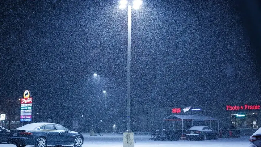
New Jersey’s next winter storm risk is less about a quick dusting and more about a high-impact mix of snow, wind, and bitter cold that can turn a “normal” forecast into a travel-and-power problem fast. The key uncertainty is the storm’s exact track and how much warmer marine air sneaks into coastal counties. That’s the difference between plowable snow inland and a sloppier, lower-accumulation mix near the Shore. Add an incoming polar-vortex-style cold shot behind the system, and the bigger threat becomes refreeze and lingering hazards after the snow stops.
Why This Storm Could Feel Worse Than the Snow Total
Even if your town ends up on the lower end of snowfall, conditions can still deteriorate quickly because:
-
Flash-freeze setup: Temperatures plunge after the system, so wet roads can refreeze into black ice.
-
Wind-driven impacts: Blowing snow reduces visibility and can redeposit snow onto cleared roads.
-
Coastal mixing risk: Sleet or a snow-sleet mix can compact into a heavier layer that’s harder to shovel and can stress tree limbs.
-
Cold after the storm: The days that follow can be as dangerous as the storm itself—especially for pipes, pets, and anyone without reliable heat.
Storm Timeline and Snow Forecast for NJ
How many inches of snow today (Friday, January 23, 2026)?
For most of New Jersey, today is not the snow day. Conditions trend colder and breezier, with the higher-confidence snow window arriving late Saturday night into Sunday.
Expected timing (statewide)
-
Friday (Jan 23): Cold building in; mainly dry.
-
Saturday (Jan 24): Bitter cold; clouds increase later. Snow risk rises late at night.
-
Sunday (Jan 25): Primary impact day. Snow likely across much of NJ, with the highest disruption potential.
-
Monday (Jan 26): Snow tapers in many areas, but wind + refreeze become the story.
Practical snowfall ranges (best planning bands)
Use these as planning ranges, not guarantees—small track changes can swing totals:
-
North & parts of central NJ (especially inland): roughly 6–12 inches possible in the higher-snow scenario, with some pockets capable of going higher if precipitation stays all snow.
-
Central NJ (many areas): roughly 4–8 inches is a realistic planning window, with heavier bands possible.
-
South NJ and the Shore: roughly 1–6 inches, but totals can be lower if mixing wins out; some places may see periods of sleet mixed in.
Quick “reality check” from city-style forecasts
-
Newark area: several inches possible Sunday, with additional light snow possible Monday morning and a note that totals could jump higher if it stays all snow.
-
Trenton area: several inches Sunday with additional light snow possible Monday; extreme cold follows.
-
Atlantic City / Shore: lower snow totals are more likely, with mixing increasing the chance of reduced accumulation.
How to Prepare for the Winter Storm
If you must drive (or might need to)
-
Treat Sunday as the no-flex day: plan errands for Saturday daylight if possible.
-
Pack a car kit: blanket, phone charger, flashlight, gloves, water, snack, small shovel, ice scraper.
-
Fill the tank before the coldest air arrives.
Home checklist that prevents the worst headaches
-
Heat + power: charge batteries, check flashlights, keep one room ready to “camp in” if needed.
-
Water + pipes: let vulnerable faucets drip, open cabinet doors under sinks on exterior walls, know where your shutoff is.
-
Food: a couple days of no-cook options helps if cooking is interrupted.
-
Outdoor prep: bring in loose items; wind can turn them into hazards.
Shoveling safely
-
Clear in layers during the storm instead of one massive shovel at the end.
-
If there’s mixing, expect heavier, denser snow: pace yourself and take breaks.
What This Means Next
-
Short-term changes: Expect rapidly evolving snowfall maps as the storm’s track sharpens. The biggest swings usually show up 12–24 hours before the main impacts.
-
Who benefits / who loses (neutral):
-
Benefits: Inland towns that stay all snow may get a cleaner plowable event with less sleet hassle.
-
Loses: Shore and near-Shore areas can get the worst combo—lower totals but heavier mix, more slush, and more refreeze.
-
-
What to watch next:
-
The “rain/sleet line” placement for coastal counties
-
Whether the cold arrives immediately after snow ends (higher ice risk)
-
Wind strength Sunday into Monday (blowing snow, visibility, and scattered outages)
-
If you tell me your NJ county or nearest town (for example: Bergen, Essex, Mercer, Ocean, Atlantic), I’ll translate this into a tighter local range and the most likely start/stop window for your area.


