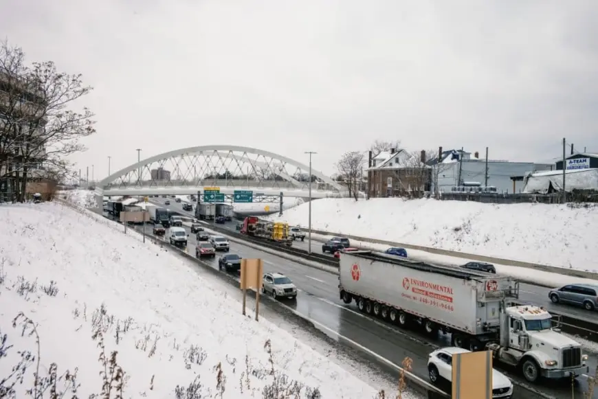
Detroit Weather: Snow, Wind, and Dangerous Cold Grip the Metro Area as Arctic Air Deepens

Detroit is in the middle of a bitter winter stretch, with snow, gusty winds, and sharply falling temperatures setting up a period of high-impact cold through the weekend and into early next week. The pattern favors frequent flurries, occasional snow showers, and temperatures that can make routine errands feel much harder—especially when wind chills drop well below zero.
Thursday starts the run with light snow and flurries, but the bigger story is the plunge that follows: daytime highs sinking into the single digits Friday and staying very cold through Saturday. Advisories have been issued around the region in response to the combination of extreme cold and wintry conditions, and residents should plan for weather-sensitive commutes and elevated cold-safety risks.
Detroit’s 7-Day Snapshot: Highs in the Single Digits, Flurries, and On-and-Off Snow
Here’s the day-by-day outlook for Detroit (local time, ET). Conditions can change quickly in this kind of pattern, so treat totals and timing as flexible.
| Day | Forecast | High | Low |
|---|---|---|---|
| Thu, Jan 22 | Mostly cloudy; breezy with snow flurries | 24°F | 2°F |
| Fri, Jan 23 | Some sun, a couple flurries; frigid | 6°F | -8°F |
| Sat, Jan 24 | Bitter cold; intervals of clouds and sun | 8°F | 5°F |
| Sun, Jan 25 | Frigid; intermittent snow/flurries, little accumulation | 15°F | 7°F |
| Mon, Jan 26 | Mostly cloudy; snow showers possible | 16°F | 5°F |
| Tue, Jan 27 | Very cold; clouds and sun | 20°F | 14°F |
| Wed, Jan 28 | Periods of snow; staying frigid | 18°F | 5°F |
What Makes This Stretch Risky: Wind, Wind Chill, and Rapid Heat Loss
When temperatures are this low, wind becomes a force-multiplier. Even if the thermometer reads in the teens or single digits, brisk gusts can drive wind chills well below zero, accelerating heat loss and raising the risk of frostbite and hypothermia. The cold also stresses infrastructure: exposed plumbing can freeze faster than many people expect, car batteries weaken, and even short outdoor tasks—like clearing a walkway—can become risky without proper layering.
If you’re heading out, assume you’ll need more time than usual. Cold starts can slow vehicles, and reduced traction can linger on untreated side streets, parking lots, and shaded stretches of road.
Commuting and Travel: Expect Slippery Patches and Sudden Visibility Changes
In this setup, Detroit often sees light, persistent snow rather than one huge burst—meaning roads can look “mostly fine” until you hit a slick patch. Flurries can also briefly cut visibility, especially in open areas where wind blows snow across lanes.
Smart moves for the next several days:
-
Leave extra following distance and brake earlier than normal.
-
Keep washer fluid rated for deep cold and a full tank (fuel line freeze issues are rare, but running low is never ideal in extreme cold).
-
Pack a quick emergency kit: gloves, hat, blanket, flashlight, and a phone charger.
-
If you must park outside, consider lifting wipers and clearing snow away from vents and tailpipes before starting the car.
Home and Health: Freeze Protection and Cold-Safety Basics
This is the kind of cold that can turn a minor oversight into a costly repair. A few practical precautions:
-
Let faucets drip slightly overnight if you’re in a freeze-prone home, and open cabinet doors under sinks to circulate warmer air.
-
Know where your main water shutoff is—just in case.
-
Check on older neighbors or anyone with limited heat access.
-
Bring pets inside and limit time outdoors for animals as well as people.
-
Space heaters: keep them away from curtains/furniture and never leave them running unattended.
What’s Next: More Chances for Snow as the Cold Lingers
After the sharpest cold arrives Friday into Saturday, temperatures stay well below typical late-January comfort levels, with periodic snow chances returning Sunday through Wednesday. The most likely impacts are not blockbuster totals but repeated light accumulations, wind-driven drifting in spots, and continued strain from the cold.
Bottom line: plan for a prolonged deep-freeze feel, keep an eye on updated advisories, and treat even “minor” snow as meaningful when pavement temperatures are this low.


