


Major Winter Storm Expected This Weekend: First Alert Weather Day
The region of Middle Tennessee and Southern Kentucky is bracing for a significant winter storm this weekend. Officials have designated Saturday and Sunday as First Alert Weather Days due to the potential impacts of the storm.
Winter Storm Watch Details
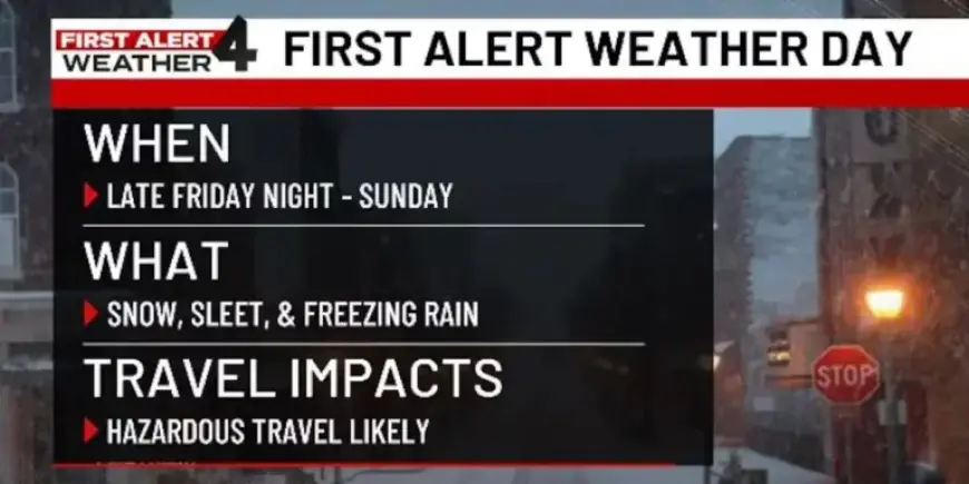
A Winter Storm Watch will commence at 6 PM on Friday and remain in effect until 6 PM on Sunday. This long-duration storm is expected to cause substantial disruptions with heavy snowfall, sleet, and freezing rain.
Timing and Severity
Winter weather activity is anticipated to begin late Friday evening and will intensify throughout Saturday. Conditions may continue to be hazardous into part of Sunday. As the storm progresses, the likelihood of travel hazards increases sharply due to accumulating snow and ice.
Forecast Variability
There is uncertainty regarding the distribution of snowfall and ice accumulation. Current forecasts suggest that regions south of Interstate 40 may experience a higher probability of icy conditions, while areas to the north might remain primarily snowy. This variability makes precise predictions challenging, as sleet and freezing rain could significantly affect overall snowfall totals.
Preparation Tips
- Purchase a snow shovel and ice melt for driveways and sidewalks.
- Ensure you have an effective ice scraper and snowbrush for vehicles.
- Review and adjust any weekend plans based on the expected weather conditions.
Staying informed and prepared is crucial as Middle Tennessee and Southern Kentucky prepare to face this major winter storm.