


Intense Snow Hits Today; Severe Cold Front Lingers Through Sunday
A significant cold front is currently impacting the Cleveland area, bringing intense snowfall and severe cold conditions. As we approach this evening, snow accumulation is projected to range between 1 to 4 inches, with heavier bursts expected.
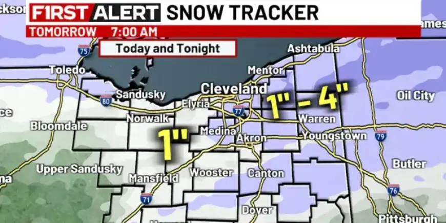
Snow Forecast Details
The snowfall is anticipated to continue into the night. Travelers should be cautious as conditions may worsen. Here’s what to expect:
- Snow Accumulation: 1 to 4 inches by 7:00 p.m.
- Additional Snow: Less than 1 inch expected overnight.
- Wind Speeds: Gusts could reach over 35 mph.
Cold Front Impacts
The temperatures during the late afternoon will peak in the 30s but will plummet as the cold front takes hold. Tomorrow’s forecast indicates:
- Daytime Temperatures: Will remain in the 20s.
- Wind Chill: Expected to drop the feel of temperatures into the teens.
Upcoming Cold Weather Conditions
By Friday, the coldest air mass of the season is set to arrive. The weather specifics include:
- Wind Gusts: West to northwest winds may exceed 35 mph.
- Temperatures: Will fall from the teens into single digits.
- Wind Chill Factors: Could plummet to between 5 and 15 degrees below zero.
- Lake-Effect Snow: Possible in the region.
Conclusion
As the severe cold front persists through Sunday, residents should prepare for intense winter conditions. Stay updated with local forecasts and take necessary precautions to ensure safety.