


Snow in Florida: Rare Panhandle Flurries Return as Arctic Air Meets Gulf Moisture
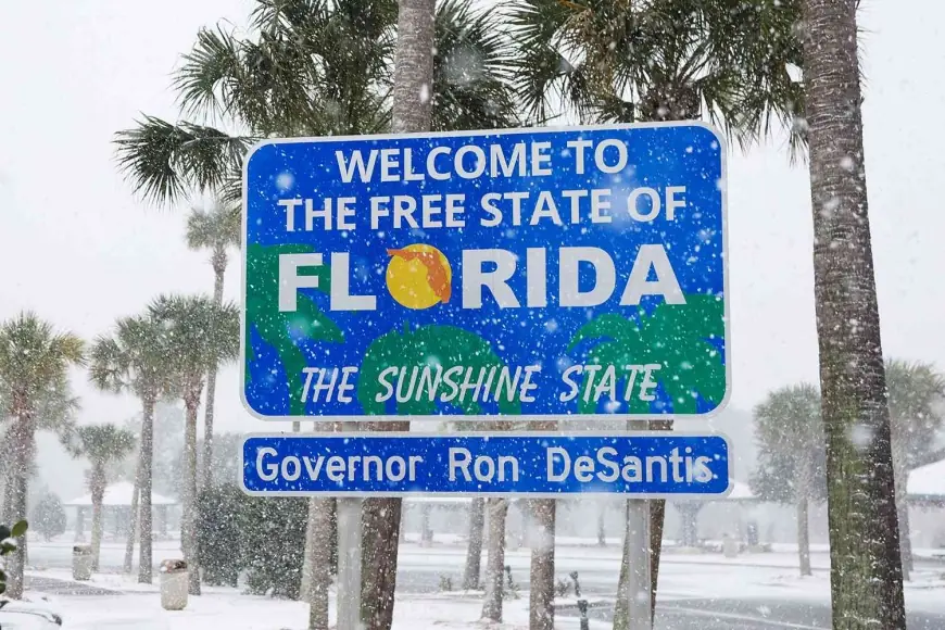
Snow in Florida is never supposed to be the headline, but early Sunday, January 18, 2026, parts of the western Florida Panhandle woke up to exactly that: snowflakes mixing in behind a sharp cold front, briefly whitening lawns, rooftops, and even a few palm fronds before melting back into the Sunshine State routine.
The event wasn’t a deep, state-shutting blizzard. It was the kind of blink-and-you-miss-it winter oddity that Floridians talk about for years, made possible by a narrow overlap of two ingredients Florida rarely gets at the same time: truly cold air and enough moisture to turn rain into snow.
Where the Snow in Florida Showed Up This Time
The most consistent reports of snow in Florida came from the far-north and western Panhandle, where temperatures dipped just low enough near daybreak for rain showers to change over to flurries. Communities in and around the Pensacola area saw the most photogenic moments, with a light dusting lingering on grass and cooler surfaces.
Places that saw at least brief flakes or a thin coating included:
-
Parts of the western Florida Panhandle, especially near the Alabama line
-
The Pensacola area and nearby inland spots
-
Milton and surrounding areas in Santa Rosa County
-
Patches along the Interstate 10 corridor where cameras showed a temporary “white-out” look on the landscape
For most drivers, the biggest impact was visual rather than hazardous: temperatures rose quickly after sunrise, and snow struggled to stick to warm pavement.
What Caused Snow in Florida on January 18
This was a classic “just enough” setup. A cold front pushed through, and in its wake a surge of Arctic air undercut lingering moisture. As the last bands of rain moved across the Panhandle, the atmosphere cooled from the top down, flipping rain to wet snow in pockets.
Meteorologists often describe this as a timing problem: Florida can get cold, and Florida can get wet, but it’s rare for the coldest air to arrive while meaningful precipitation is still falling. On January 18, the overlap window opened briefly in the Panhandle and closed fast.
Alerts, Advisories, and What Actually Happened on the Ground
Winter weather alerts covered parts of north Florida and adjacent areas of Georgia heading into Sunday morning, with the main concern focused on short-lived bursts of snow and the possibility of slick spots on bridges and overpasses where temperatures were lowest.
In practical terms, the Florida portion of the event leaned more “novelty” than “disruption”:
-
Snow accumulated lightly on grass and rooftops in spots
-
Roads were mostly too warm for lasting accumulation
-
Any coating that did appear tended to melt quickly as temperatures rebounded
The bigger winter impacts from the same storm system were aimed farther north and east, where colder air and heavier precipitation aligned for longer.
Why This Matters: Back-to-Back Winters With Snow in Florida
What made this round of snow in Florida especially notable is the timing: it arrived almost exactly one year after a much more significant Gulf Coast winter storm that produced record-setting snowfall in parts of the Panhandle. That 2025 event reset expectations about what’s “impossible” in the region, and it also raised a new question: could Florida really see meaningful wintry precipitation in consecutive winters?
For the Panhandle, the answer now appears to be yes—at least at the “measurable in spots or briefly accumulating” level. Even a tenth of an inch is enough to put an event into the record books for some observing sites, and it reinforces that Florida’s northern edge can occasionally behave like the Deep South during the sharpest cold outbreaks.
What’s Next After the Snow in Florida Surprise
For most of Florida, the bigger story after the flakes is the cold itself. Behind the front, colder-than-normal nights can stress pets, plants, and pipes in parts of North Florida, even when snow doesn’t stick around.
If you’re in the Panhandle or North Florida, the main near-term watch-outs are:
-
Overnight refreezing on elevated road surfaces if skies clear
-
Frost risk for vegetation during the coldest pre-dawn hours
-
Quick temperature swings that can catch travelers off guard
Snow in Florida remains rare, but January 18 showed—again—that the Panhandle sits close enough to winter’s southern boundary that the right storm track can briefly turn beaches and palm trees into a postcard from somewhere much farther north.


