


Southern Ontario Weather: Brutal Cold Locks In, Intermittent Snow and Flurries Through Midweek
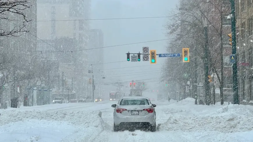
Southern Ontario is settling into a sharp, sustained cold spell, with daytime highs widely stuck below freezing and wind-driven flurries pulsing off the lakes at times. After a breezy Saturday, Sunday, January 18 turns colder area-wide, and the chill deepens Monday–Tuesday before a modest midweek moderation arrives. Travel impacts look most likely in traditional lake-effect corridors and during brief squalls, while urban centres face biting wind chills and slick patches from on-and-off light snow.
What’s driving the Southern Ontario weather pattern
A reinforcing push of Arctic air is sliding across the lower Great Lakes, dropping temperatures well below seasonal norms and priming the setup for bursts of snow where winds align across open water. The coldest air settles in Monday and Tuesday, when a brisk northwest flow supports periodic snow showers and blowing snow in exposed areas. By Wednesday, a weak clipper and shifting winds bring a notch-up in temperatures but keep intermittent snow in the mix.
Temperature snapshot: widespread subfreezing days
-
Toronto & GTA: Highs near -4°C Sunday, edging to -4°C to -1°C Monday–Wednesday. Nights fall to -7°C to -13°C at times, with colder wind chills.
-
Hamilton to Niagara: Highs -5°C to 0°C through Wednesday; lows -8°C to -12°C. Occasional flurries may dust roads and reduce visibility briefly.
-
Kitchener-Waterloo/Guelph: Expect some of the deeper overnight cold, -10°C to -16°C, with daytime highs -8°C to -3°C.
-
London & corridor along 401: Bitter wind Monday–Tuesday; periodic snow showers and squalls possible, especially west/north of the city.
-
Windsor-Essex: Cold for the region with highs -6°C to 0°C and blustery spells Monday; brief squalls may create whiteouts in open stretches.
-
Barrie/Simcoe: The cold bites hardest here, with highs -11°C to -2°C and frequent flurry chances given proximity to Georgian Bay.
Southern Ontario weather hazards to watch
Brief squalls and reduced visibility: While most periods feature light snow or flurries, any heavier snow shower can quickly coat roads and produce sudden drops in visibility. Expect this risk to peak Monday into Tuesday, especially downwind of Lake Huron, Georgian Bay, and along the QEW/401 corridors during wind-aligned bursts.
Wind chills and icy surfaces: Gusty winds funnel through Monday–Tuesday, pushing apparent temperatures well below air readings. Re-freezing will be common each night, so black ice remains a recurring hazard on untreated surfaces.
Midweek “not as cold,” but still wintry: Temperatures tick up slightly Wednesday without a full thaw; intermittent snow remains possible, and slushy spots may re-freeze after sunset.
3-day outlook at a glance (ET)
| City | Sun Jan 18 | Mon Jan 19 | Tue Jan 20 |
|---|---|---|---|
| Toronto | Colder, sun & low clouds, -4°C / -7°C | Mostly cloudy, windy, a few flurries, -4°C / -13°C | Sunny intervals, bitterly cold, -10°C / -11°C |
| Hamilton | Low clouds, -5°C / -7°C | Windy, a couple flurries, -4°C / -14°C | Partly sunny, bitter cold, -10°C / -11°C |
| London | Low clouds, -7°C / -8°C | Windy, a few snow showers, -7°C / -18°C | Very cold, some sun, -12°C / -14°C |
| Kitchener | Low clouds, -8°C / -10°C | Cloudy, a few snow showers, -8°C / -16°C | Bitter cold, a couple snow showers, -13°C / -15°C |
| Niagara Falls | Low clouds, flurries, -4°C / -7°C | Increasing wind, a little snow, -5°C / -14°C | Brisk, bitter cold, -9°C / -12°C |
| Windsor | Cold, a couple flurries late, -5°C / -7°C | Snow squalls at times, windy, -6°C / -14°C | Mostly cloudy, bitter cold, -8°C / -11°C |
| Barrie | Low clouds, -6°C / -10°C | Windy with periods of snow, -6°C / -15°C | Brisk, bitter, a few snow showers, -11°C / -13°C |
Temperatures are daytime high / overnight low. “Bitter” denotes notable wind chill; squall timing is variable.
Travel and daily-life planning tips
-
Commutes: Allow extra time Monday–Tuesday in known snowbelts and along exposed stretches of the 401/402/QEW/400. Visibility can drop fast under a passing band.
-
Sidewalks & driveways: Re-freeze is likely each night; re-salt early mornings and after sunset.
-
Dress for wind: Layer with wind-blocking outerwear. Extremities cool quickly when gusts increase.
-
Home & vehicle: Keep washer fluid topped up and emergency kits in cars; monitor indoor humidity to reduce window icing.
Southern Ontario weather: what’s next?
The core of the Arctic air eases slightly by Wednesday, bringing “not as cold” conditions—but still below freezing—with intermittent snow or flurries lingering. Another push of colder air and scattered light snow is possible late week, so expect the freeze to hold through Friday with only brief, limited thaws. Forecast details may evolve as wind trajectories shift; check the latest local updates before heading out, especially if traveling through lake-effect zones.


