


First Alert: Lake-Effect Snow Eases Tonight, Returns Friday
Cleveland, Ohio, is experiencing typical winter weather as temperatures remain in the teens, with wind chills slightly above zero. Tonight, residents can expect clear skies, but conditions will change as system snow enters the region tomorrow.
Snow Forecast for Northeast Ohio
The snow will begin late Friday morning and is anticipated to continue until early evening, around sunset. Accumulation is expected to be minimal, with forecasts indicating an inch or less of snow. However, some areas could see higher totals, reaching up to two inches.
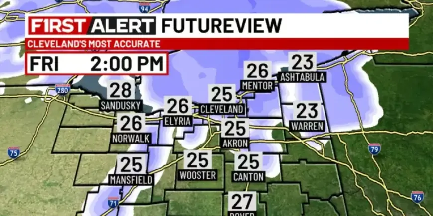
Friday’s Weather Overview
- Morning: Dry conditions to start the day.
- Afternoon High: Expected to reach around freezing (32 degrees).
- Wind: Gusty conditions will persist throughout the day.
Following a brief lull in precipitation Friday evening, another round of system snow is expected late Friday night. This will likely bring an additional accumulation of two inches or less.
Weekend and Holiday Outlook
Residents can look forward to a dry Sunday; however, temperatures will remain cold, staying in the teens throughout the afternoon. Monday, which is Martin Luther King Jr. Day, may see the return of lake-effect snow along with brisk winds.
On Tuesday morning, there is potential for dangerously cold wind chills as temperatures drop into single digits. Wind chills could reach as low as 10 degrees below zero or colder, necessitating caution.
Extended Weather Predictions
Arctic air is predicted to dominate conditions from Tuesday afternoon into Wednesday, with another round of snow projected for the midweek period. Residents should stay alert for updates on weather conditions as they plan their activities.


