


Frigid Air Returns with Snow Showers Tonight in Mid-Ohio Valley
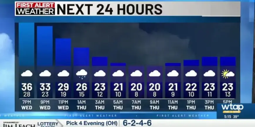
A significant drop in temperature is expected to affect the Mid-Ohio Valley tonight as a wave of Arctic air brings snow showers. The arrival of these snowflakes is projected between 6 p.m. and 8 p.m. local time.
Weather Forecast for the Mid-Ohio Valley
This evening, residents should prepare for scattered snow showers. While these showers are not predicted to lead to substantial snow accumulation, motorists should be cautious, as roads may become slick by Thursday morning.
Temperature Outlook
- Thursday will experience cold weather with temperatures in the mid-20s.
- Highs will remain in the 20s and lows will drop into the teens through next Tuesday.
After a relatively dry Thursday, the region could see more significant snow activity over the weekend. Friday is expected to start dry, but snow showers may arrive late in the evening and carry into Saturday morning.
Potential Snow Accumulations
- Predicted snow accumulation from the weekend system is around 1 inch, with some areas possibly reaching up to 2 inches.
- The West Virginia side of the Ohio River is likely to see the greatest amounts.
Following the snow, temperatures will drop again, extending the chill into the following week. A brief warm-up is anticipated around Wednesday, when temperatures may finally rise above freezing.


