


Severe Storms and Strong Winds Sweep Through Chicago: Live Updates
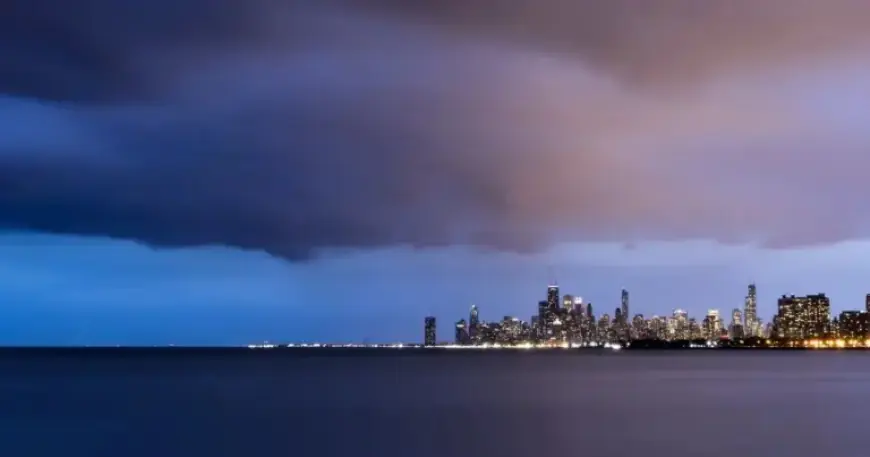
Severe storms and strong winds moved across the Chicago area and northwest Indiana on Thursday. A powerful cold front brought a rapid temperature drop and scattered thunderstorm activity.
Alerts and Watches
The National Weather Service and local forecasters issued multiple watches and warnings. A severe thunderstorm watch covered parts of Illinois, Indiana and Iowa until 11 p.m.
Timeline of advisories
- 4:16 p.m. — Severe thunderstorm watch in effect along and south of I-80 until 11 p.m.
- 4:37 p.m. — Severe warning included Hammond IN, Gary IN and Tinley Park IL until 5:15 p.m.
- 4:51 p.m. — Warning expanded to Hebron IN, Kouts IN and Malden IN until 5:15 p.m.
- 4:56–4:57 p.m. — Warnings covered Portage, Valparaiso and Chesterton IN; southern Cook County later removed.
- 5:01 p.m. — O’Hare Airport issued a ground delay through midnight.
Risk and primary threats
The Storm Prediction Center placed far southern Chicagoland in a Level 3 enhanced risk. Areas along and south of I-80 faced the greatest threat for severe storms.
Forecasters warned of large hail and damaging wind gusts. Localized flooding was possible in southern neighborhoods.
Tornado potential
The tornado threat was described as lower than the March 10 outbreak. However, isolated tornadoes could occur near and south of the Kankakee River Valley.
Recent severe weather context
On March 10, at least four tornadoes struck parts of Illinois and Indiana. That event killed three people and caused numerous injuries.
An EF-3 tornado produced winds near 150 mph and heavy structural damage in northwest Indiana. The same system also generated very large hail.
Temperature changes and timing
Temperatures began falling as the cold front passed. Readings were expected to drop into the 40s by evening.
The National Weather Service said temperatures could fall about 25 degrees quickly. Lows were forecast near 30 degrees overnight.
Short-term forecast
Forecasters expected the severe threat to end by 10 or 11 p.m. in the Chicagoland area. Friday would remain chilly with highs near the low 40s.
A gradual warm-up was forecast through the weekend. Highs climbed near 50 on Saturday, into the low 60s on Sunday, and near 70 by Monday.
Travel and safety notes
O’Hare’s ground delay could affect departures and connections through midnight. Drivers should prepare for strong winds and sudden downpours.
Residents were advised to monitor local channels and live updates for rapidly changing conditions. Keep small valuables secured during hail and gusty winds.
Reporting details were provided by FOX Chicago Weather and the National Weather Service in Chicago. Filmogaz.com compiled this summary from those sources.