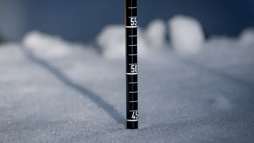
The Blizzard of 2026 has buried New Jersey under historic snowfall, with the northern and central parts of the state recording the deepest totals. Here are the latest official snowfall totals from the National Weather Service and the North Jersey Weather Observers as of Monday, February 23, 2026. Snow is still tapering off in southern areas — final totals may be slightly higher in some locations.
Bergen County (North Jersey)
| Town |
Inches |
| Moonachie |
24.3" |
| Ridgefield |
23.2" |
| Leonia |
22.0" |
| Carlstadt |
21.4" |
| Cresskill |
19.5" |
| Franklin Lakes |
19.5" |
| River Edge |
17.0" |
| Westwood |
17.0" |
| Park Ridge |
14.8" |
| Montvale |
14.0" |
| New Milford |
12.0" |
| Oradell |
11.3" |
| River Vale |
10.0" |
Essex County
| Town |
Inches |
| Orange |
24.0" |
| Montclair |
19.0" |
| North Caldwell |
18.8" |
| Millburn |
16.0" |
| Glen Ridge |
16.0" |
| West Orange |
14.0" |
Hudson County
| Town |
Inches |
| Kearny |
19.0" |
| Hoboken |
18.5" |
| Harrison |
17.0" |
| Union City |
16.0" |
Monmouth County ⭐ NJ State Leader
| Town |
Inches |
| Freehold |
24.2" |
Essex / Morris Counties
| Town |
Inches |
| Newark |
23.0" |
| Chatham (Morris Co.) |
20"+ |
| Morristown |
11"+ |
Middlesex County
| Town |
Inches |
| Cranbury |
20"+ |
Mercer County
| Town |
Inches |
| Lawrenceville |
14.0" |
| West Windsor Twp |
15.5" |
| Hamilton Square |
9.8" |
| Trenton Mercer Airport |
7.9" |
| Ewing |
7.7" |
| Robbinsville Twp |
7.5" |
| Pennington |
4.5" |
| Hopewell |
3.0" |
Burlington County
| Town |
Inches |
| Mount Holly NWS |
18.5" |
| Lake Pine |
18.0" |
| Chesterfield (3 SSW) |
15.9" |
| Bordentown |
14.0" |
| Chesterfield |
11.5" |
| Hainesport |
9.9" |
| Tabernacle |
9.3" |
| Columbus |
9.0" |
| Moorestown |
7.6" |
| Lumberton |
7.5" |
| Evesham Twp |
7.5" |
| Marlton |
7.0" |
| Delran |
6.8" |
Camden County
| Town |
Inches |
| Lindenwold area |
16.5" |
| Blackwood |
12.0" |
| Mt. Ephraim |
11.0" |
| Collingswood |
10.0" |
| Gibbsboro |
10.0" |
| Pine Hill |
9.3" |
| Bellmawr |
8.0" |
| Haddon Heights |
7.5" |
| Haddon Township |
7.2" |
| Cherry Hill |
6.0–7.0" |
| Stratford |
4.5" |
Atlantic County
| Town |
Inches |
| Atlantic City Intl. Airport |
14.5" |
| Mays Landing |
14.0" |
| Margate City |
13.0" |
| Atlantic City (2W) |
12.6" |
| Galloway Twp |
12.1" |
Ocean County
| Town |
Inches |
| Toms River |
12"+ |
| Berkeley Twp |
14.0" |
Storm at a Glance
| Stat |
Detail |
| NJ State Leader |
Moonachie / Freehold (~24") |
| Heaviest Region |
Bergen, Essex, Monmouth, Hudson Counties |
| Lightest NJ Totals |
South Jersey shore communities |
| Peak Snowfall Rate |
Up to 3–4" per hour overnight |
| Wind Gusts |
Up to 60 mph along the coast |
| Power Outages |
100,000+ customers statewide |
| Travel Ban |
Lifted noon ET Monday, Feb. 23 |
| NJ Transit |
Suspended — no return time announced |
Northern New Jersey saw some of the biggest totals in the entire region. Freehold hit 24.2 inches. Ridgefield in Bergen County reached 20.6 inches, with many surrounding towns, including Leonia, Tenafly, and parts of Union County, piling up 17 to nearly 19 inches.
The heaviest snow is expected to wind down in New Jersey around 12:00 PM ET, with lighter snow lingering until 5:00 PM ET. Newark recorded 23 inches after a heavy snow band sat over the region overnight. Conditions on back roads remain dangerous — even after the travel ban lifted at noon, officials are urging residents to stay home where possible and watch for overnight refreezing.