


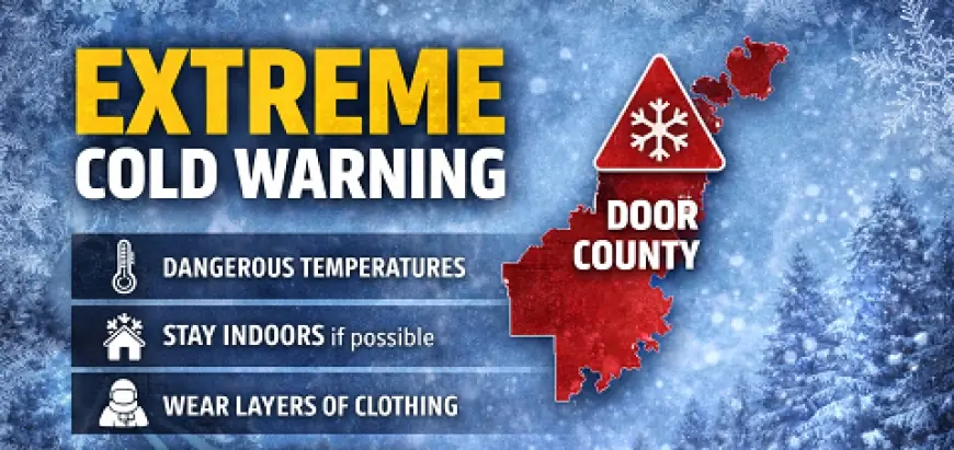
Extreme Cold Warning and Polar Vortex Air Put Milwaukee in the Deep Freeze as Boston Braces for Bitter Cold and Weekend Snow
A fresh plunge of Arctic air is turning routine winter weather into a safety issue across the Midwest and Northeast. The headline isn’t just “cold”—it’s how quickly exposed skin can be harmed, how easily vehicles and plumbing can fail, and how long the pattern can linger when the polar vortex is displaced. Milwaukee is facing the harshest end of this setup, while Boston is dealing with a sharp temperature drop that collides with a snowy weekend stretch and messy travel conditions.
Why this cold is different: wind chill, duration, and the polar-vortex pattern
Extreme Cold Warnings are reserved for the kind of conditions where the body loses heat faster than it can produce it—especially when wind turns already-low temperatures into dangerous wind chills. This is the type of cold that punishes small mistakes: a short walk without face coverage, a stalled car with a low tank, a space heater used improperly.
What’s driving the intensity is a polar-vortex pattern that allows very cold air to surge south and hang around in repeated waves. The uncertainty now isn’t whether it’s cold—it’s how long the coldest core stays close enough to keep wind chills brutal, and whether the Northeast storm track produces heavier snow bands or more modest totals.
A useful way to think about it:
-
Temperature tells you how cold the air is.
-
Wind chill tells you how dangerous it feels on skin and how fast frostbite risk rises.
-
Duration tells you how likely secondary impacts become (burst pipes, dead car batteries, shelter demand, school/work disruptions).
Milwaukee vs Boston: two different problems under the same Arctic dome
Milwaukee is in the “life-safety” category first. The current warning period highlights wind chills deep below zero, where even brief exposure can be risky. The cold eases somewhat after the worst window, but the broader pattern stays frigid for days.
Boston’s setup is slightly different: a quick fall from relatively mild daytime readings into single digits at night, followed by bitter daytime highs. At the same time, snow is expected to arrive later in the weekend and continue into early next week, creating a one-two punch of cold-plus-snow that can snarl roads and slow commutes.
10-day planning highlights: Milwaukee
These are the main inflection points rather than every detail:
-
Fri (Jan 23): brutal core of the outbreak, high near -6°F / low near -11°F
-
Sat–Tue: still frigid, with highs mostly single digits to mid-teens
-
Sun–Mon: intermittent snow/flurries are possible, but the bigger issue remains cold
-
Late week: gradual “less awful” trend, but still well below seasonal comfort
10-day planning highlights: Boston
Boston’s big story is the whiplash and the snow timing:
-
Fri (Jan 23): colder and breezy, high near 31°F, then plunging to around 2°F overnight
-
Sat: bitter daytime cold, high near 13°F
-
Sun–Mon: snow develops and continues at times; totals can vary by storm track
-
Mid to late week: cold persists with highs commonly around 19–24°F
What to do (and what not to do) during extreme cold
-
Cover skin completely (hat + gloves + face/neck protection). Wind makes “feels-like” the real danger.
-
Avoid long idling in enclosed areas (carbon monoxide risk).
-
Keep a car winter kit (blanket, phone charger, gloves) and don’t let the gas tank run low.
-
Protect plumbing (let faucets drip if needed; open cabinet doors under sinks on exterior walls).
-
Check on neighbors who may lack reliable heat; cold emergencies strain shelters quickly.
What This Means Next
In the short term, Milwaukee’s focus is surviving the peak wind-chill window and avoiding preventable emergencies (frostbite, stranded motorists, heating mishaps). Boston’s focus is timing: the cold sets the stage, and the snow adds friction—roads, transit, and flights can unravel fast when temperatures stay low enough that melting and refreezing become constant.
Who benefits (neutral)
-
People who can stay indoors and shift schedules away from early-morning exposure
-
Remote workers and students who can avoid commutes during the worst wind chills or snow onset
Who loses (most exposed)
-
Outdoor workers, unhoused residents, and anyone without dependable heat
-
Drivers in older vehicles or anyone traveling long distances during the coldest hours
-
Small businesses reliant on walk-in traffic when conditions make “going out” unsafe
What to watch next
-
Whether the coldest wind-chill corridor shifts east, tightening impacts in the Great Lakes or interior Northeast
-
Any extensions or re-issuance of cold warnings if wind and temperature align again
-
Snow band placement near Boston Sunday into Monday, which can turn “manageable” into “gridlocked” quickly
If you want this tailored to your exact needs, tell me which city you care about most (Milwaukee or Boston) and whether you want the forecast written for commuters, parents/schools, or travelers.


