


Winter Storm Watch This Weekend: Snow, Sleet, and Ice Threaten Texas, the Ohio Valley, and the Northeast (January 2026)
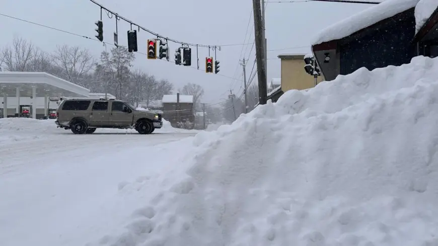
A major January 2026 winter storm is shaping up for a disruptive weekend, with the highest-impact hazards split between a damaging ice corridor in the South and heavy, wind-driven snow farther north and east. Winter storm watches are posted across multiple states, signaling a high likelihood of travel trouble, power disruptions, and rapid temperature drops that can turn wet roads into black ice within hours.
Forecast confidence is highest on the big picture: an arctic air mass pushes deep into the Plains and South, while a storm system rides along the boundary and spreads moisture from Texas through the Ohio Valley into the Mid-Atlantic and Northeast. The hardest part—especially for Texas and the Mid-South—is exactly where the rain-to-ice-to-snow transition sets up, because small temperature changes can flip outcomes from “just cold rain” to a crippling glaze.
Winter Storm Fern outlook: timing and where impacts peak
The most likely window for significant impacts runs from late Friday through early Monday.
-
Friday afternoon/night: cold air deepens; wintry precipitation begins in parts of Texas and the Southern Plains.
-
Saturday: the ice risk increases south of the main snow band; sleet and snow expand north of the ice zone.
-
Sunday into early Monday: the storm shifts east; heavier snow threats focus on the Ohio Valley, Mid-Atlantic, and Northeast while bitter cold follows behind and refreezing becomes a major hazard.
Even where snowfall totals are modest, ice can produce the most severe disruptions—downed tree limbs, power line damage, and roads that remain hazardous longer than expected.
Dallas weather: how much snow are we getting this weekend?
For the Dallas–Fort Worth area, the standout risk is a prolonged period of wintry precipitation with temperatures staying below freezing long enough for ice and sleet to accumulate.
Current guidance supports:
-
Ice accumulation in the roughly one-quarter to one-half inch range in parts of North Texas before a transition to sleet and snow.
-
Sleet and snow totals in the “multiple inches” category for many communities, with a commonly projected range around 2–5 inches in the most favored corridor.
The biggest practical message for DFW: this is not just a “snow forecast.” If icing develops first, road conditions can deteriorate faster than snowfall maps suggest—especially on bridges, overpasses, and elevated ramps.
Austin weather: sleet, light ice, and brief snow chances
Central Texas sits near the most volatile part of the setup. The current expectation leans toward a wintry mix with the primary concern being slick travel on elevated surfaces and untreated roads rather than deep snow.
Planning ranges being discussed for the Austin area include:
-
Light ice potential (often described in tenths of an inch in the most impacted spots).
-
Intervals of sleet and occasional snow flurries late Saturday into Sunday, with any snow accumulation highly dependent on surface temperatures during peak precipitation.
If temperatures hover just below freezing, roads can ice over even with light precipitation.
Houston weather: “ice-first” risk and dangerous bridges
For the Houston metro, the threat is more about a window of below-freezing temperatures and localized icing than widespread snow. The most likely trouble spots are typically the same every time: flyovers, overpasses, and shaded stretches that freeze first and thaw last.
What to watch:
-
How long temperatures remain below freezing (a longer subfreezing stretch increases the chance that even light precipitation creates hazardous roads).
-
Whether precipitation arrives during the coldest part of the night or early morning, when icing is most efficient.
Snow is possible in brief bursts if cold air wins out, but the higher-probability disruption is a glaze that creates surprise slick spots.
Cincinnati weather and the Ohio Valley: a higher-confidence snow event
The Tri-State and surrounding Ohio Valley have a stronger signal for a plowable snowfall event, with several forecast packages highlighting a solid chance of a significant accumulation from Saturday afternoon through late Sunday.
Current planning ranges:
-
6 to 10+ inches in the most likely higher-impact scenario, with localized higher totals if heavier bands set up and persist.
Wind and falling temperatures can also create drifting and reduced visibility, compounding travel problems even after snow begins to taper.
NYC snow forecast: Sunday snowstorm potential and inches
Confidence is increasing for a meaningful snow event in the NYC area this weekend. The most consistent projections cluster around a significant, disruptive snowfall if the storm track stays favorable and the changeover line remains south and east of the city long enough.
Current planning ranges frequently cited:
-
A widespread 6–10 inches as a reasonable middle scenario for much of the metro.
-
A higher-end outcome—locally up to the mid-teens in inches—if a heavy band stalls over parts of the region.
The most important “swing factors” for NYC:
-
Where the heaviest snow band sets up (it can shift 20–50 miles and dramatically change totals).
-
How quickly any mixing with sleet occurs, which can cut totals but worsen road traction.
How to prepare for a winter storm or ice storm this weekend
Ice and sleet often cause the worst real-world impacts, so preparation should focus on mobility, heat, and power resilience:
-
Travel: avoid nonessential driving during onset; if you must go out, carry blankets, water, a phone charger, and a small shovel or traction aid.
-
Power and heat: charge devices; keep flashlights ready; use only safe, vented heat sources—never run grills or generators indoors or in garages.
-
Home protection: insulate exposed pipes; drip faucets if local guidance recommends; know where your main water shutoff is.
-
Food and medicine: stock 2–3 days of essentials; refill prescriptions early.
-
Vehicles: fill the tank, check tire tread, and top off cold-rated windshield washer fluid.
This weekend’s storm has a classic “high-impact boundary zone,” meaning final snow and ice totals can still shift. The safest plan is to prepare for the higher-impact scenario in your area—especially where ice is on the table—because small forecast changes can produce outsized consequences.