


Weekend Snow Forecast: Track Shifts, Likelihood of Significant Snow Increases
The weekend weather forecast indicates a significant winter storm is approaching parts of the United States, impacting regions from Texas to the Northeast. The storm is characterized by an ice storm in the Deep South and heavy snowfall expected further north. Over the past day, updates on the storm’s track and impact have changed, but predictions for substantial snowfall remain consistent.
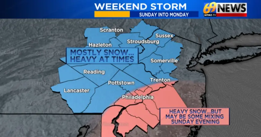
Storm Timing and Development
Snow is expected to begin around sunrise on Sunday morning, continuing into Sunday night. The most intense snowfall, with rates potentially reaching 1 to 2 inches per hour, is anticipated from late Sunday morning through early evening. Meteorologists are closely monitoring the storm’s track, noting that a coastal low may move farther north than initially predicted, increasing the likelihood of widespread snowfall.
Snow Type and Conditions
The weather is expected to remain predominantly snowy due to the arrival of arctic air. Temperatures will remain in the teens throughout the weekend, supporting the formation of light and fluffy snow. If the storm shifts nearer to the coast, there could be local mixing along the I-95 corridor, but heavy snow will precede any mixing.
Snowfall Predictions
Ultimately, the accumulation predictions are significant. Current assessments suggest a 90% probability of at least 6 inches of snow across the affected areas. More encouragingly, there is now over a 50% chance of some regions receiving a foot or more of snow.
- 90% chance of at least 6 inches of snow
- 50% chance of 12 inches or more
- 10% chance of local areas seeing 18 inches
Forecasting Updates
Due to recent shifts in the storm’s trajectory, there is still some uncertainty regarding exact amounts. Meteorologists aim to provide detailed snowfall forecasts by Thursday evening or Friday morning, depending on the accuracy of incoming data. This timeline is crucial as it typically marks the standard for issuing snowfall maps, which will specify more precise forecasts.
Conclusion
A major winter storm is on track to impact vast areas this Sunday. With forecasts suggesting a minimum of 6 inches and an increasing potential for greater totals, residents should prepare for challenging conditions. It remains crucial to stay updated on the latest forecasts as we move closer to the event.