


Weather Alert: Cold and Possible Snow Expected Friday to Sunday
Residents of Fort Wayne, Indiana, should prepare for a significant weather shift from Friday to Sunday. A cold snap, coupled with the possibility of snow, has prompted local meteorologists to issue First Alert Weather Days.
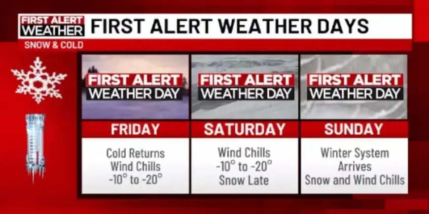
Forecast Overview
- Date Range: Friday to Sunday.
- Temperatures: Expected lows of -5º on Friday night.
- Wind Chill Values: Reaching as low as -20º on Friday and -10º on Saturday.
Friday’s Weather Conditions
Friday will start cold, with highs barely reaching the upper teens. As night falls, temperatures will drop significantly, likely hitting around -5º. Wind chill will make conditions feel even colder.
Saturday and Sunday Snow Forecast
A weather system from the Southwest is predicted to move through the South and Mid-Atlantic regions, potentially affecting Fort Wayne. On Saturday, residents will experience bitter cold, with wind chills near -10º, before light snow begins Saturday evening.
- Snow Accumulation: Initial estimates suggest between 2-4 inches, with some forecasts indicating higher totals.
- Snow Type: Expected to be dry and powdery, which may lead to more effective accumulation.
Moving Forward
Conditions will likely improve by Monday as the storm system exits the region. However, cold air will linger, with daytime highs remaining in the teens.
Stay informed by checking updates from Filmogaz.com for the latest weather developments.