


Snow in Florida 2026: Rare Panhandle flakes return as winter storm brushes Georgia and the Southeast
A rare round of snow in Florida returned this morning, with bursts of light to moderate flakes reported across parts of the western Panhandle—enough to dust rooftops, car tops, and grassy areas from Pensacola east toward small inland communities. The event is short-lived but notable: it’s the second winter in a row the Sunshine State has seen snow, while nearby Georgia has picked up wider coverage of wintry weather as the storm arcs up the East Coast.
Where it’s snowing in Florida today
Early today (Sunday, January 18, 2026), colder air slipping in behind a passing front allowed lingering showers to flip to snow for a time. While pavement temperatures limited impacts on major roads, quick coatings arrived on untreated surfaces during heavier bursts.
Panhandle snapshot
-
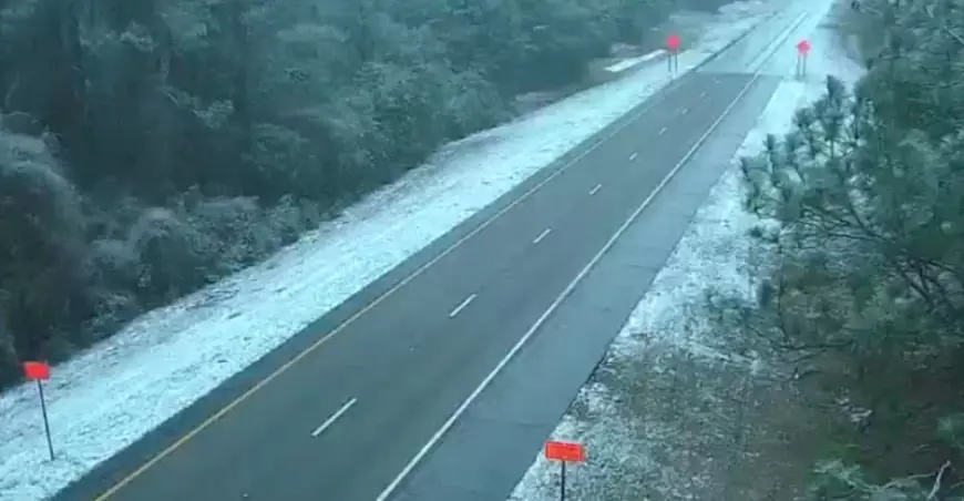
Pensacola: On-and-off snow showers early; spotty coating on colder surfaces. Roads mainly wet to slushy in brief bursts.
-
Milton & inland Santa Rosa/Okaloosa: Better chance for sticking on grass and elevated surfaces; localized light accumulation.
-
Tallahassee/Big Bend: Mostly cold rain with a brief chance of flakes north and west of the city; little to no accumulation expected.
Totals so far across the Panhandle are generally a trace to around a half-inch where the steadier snow set up, with localized higher pockets possible if a narrow band lingers. Any accumulation fades quickly once snow ends or sun breaks through.
Snow in Georgia and the wider Southeast
Farther north, snow in Georgia has been more widespread, with flurries to light accumulations reported from central sections into parts of metro corridors. Many communities have landed in the 1–3 inch range where bands have persisted, especially on grassy areas and secondary roads. Travel impacts have been variable—most pronounced during heavier bursts and on bridges, ramps, and elevated decks. In Atlanta, scattered snow showers and flurries moved through with marginal road sticking, then tapered from southwest to northeast through the afternoon.
Snowfall weather forecast: what’s next today and tonight
The broader storm stretches from the Gulf Coast to New England. For the Deep South, the window for flakes closes from west to east late today, followed by a colder night that may refreeze slush and wet spots.
Remainder of Sunday (ET)
-
Western Florida Panhandle (Pensacola–Milton): Intermittent light snow/drizzle fades through late afternoon; patchy slick spots possible in heavier bursts.
-
Tallahassee area: Predominantly cold rain; a brief mix possible north/west of the city before ending.
-
South/central Georgia (including Atlanta): Lingering flurries end; breaks in clouds late.
Tonight
-
Temperatures dip below freezing inland; watch for refreeze on untreated roads, sidewalks, and overpasses.
-
Any remaining clouds thin from west to east; winds ease.
Quick answers to trending searches
-
Is it snowing in Florida right now?
Yes—light snow occurred this morning in parts of the western Panhandle, especially near Pensacola and inland communities such as Milton. Intensity and coverage are diminishing. -
Snowfall weather forecast for the Panhandle:
Most spots: a trace to 1″ on colder surfaces; isolated up to 2″ where a band lingered. Many locations will see less, with roads mainly wet except during bursts and after dark. -
Snow in Georgia today:
Numerous reports of flurries to light accumulations; many central areas landed 1–3″ on colder surfaces. Atlanta weather: flurries with limited sticking; improving late day, but watch for refreeze tonight. -
Weather forecast snow storm for the Southeast:
The storm shifts northeast through tonight. Southern flakes wind down; colder air remains into Monday morning.
City-by-city at a glance
| Location | Snow Today (so far) | Remainder of Day (ET) | Tonight (ET) |
|---|---|---|---|
| Pensacola, FL | Flurries to light coating | Isolated light snow/drizzle, then ending | Clearing, refreeze risk on wet spots |
| Milton, FL | Coating on grass/elevated areas | A few additional bursts possible, localized | Sub-freezing lows inland |
| Tallahassee, FL | Mainly cold rain; brief flakes | Chance of a brief mix north/west; little stick | Clearing, patchy black ice inland |
| Atlanta, GA | Flurries; spotty light accum. | Tapering; roads improving | Colder; icy patches where wet |
Note: Amounts vary street-to-street. Forecasts can shift if a narrow snow band wobbles 20–30 miles.
Safety and travel tips
-
Treat bridges, overpasses, hills, and shaded stretches as potentially slick—especially after sunset.
-
Even where totals are low, a quick burst can briefly cut visibility and lay down slush.
-
If you must travel, reduce speed, leave extra space, and avoid sudden braking.
What this means for Monday
The storm exits, but the cold lingers. Morning commuters should plan on refreeze concerns where surfaces stayed wet this evening. Sunshine returns in many areas later Monday, helping conditions improve.
For those searching “weather near me,” “snow today,” or “what is the weather,” the headline remains the same: a rare Florida snow in the Panhandle, modest snow in Georgia, and a fast-moving winter system shifting up the coast, with the main southern impacts winding down by tonight.