


Weather: Blizzard Slams NYC and the Tri-State — Widespread Snow, Fierce Winds and Major Travel Disruptions
The core impact is immediate and local: neighborhoods, airports and coastal communities are bearing the brunt of a nor'easter that has produced blizzard conditions across the Tri-State area and the broader Northeast. This weather event is pushing visibility below a quarter mile in places, piling up double-digit snow totals, knocking down trees and triggering widespread travel chaos — and those consequences are unfolding now.
Weather impact: neighborhoods, airports and emergency zones under strain
Here’s the part that matters: more than 40 million Americans are under blizzard warnings, and states of emergency that began in New York and New Jersey have been expanded to include Connecticut, Delaware, Massachusetts and Rhode Island. The storm’s combination of heavy snow, high wind and coastal onshore flow is stressing local response systems, prompting flight waivers and mass cancellations and elevating the risk of power outages and coastal flooding through this evening.
Storm details embedded in the impact
A powerful nor'easter is producing rapidly rising snow totals and damaging wind gusts across the Tri-State area. Visibility across much of the region has dropped below a quarter mile at times. Winds have been gusting in the 40 to 50 mph range, with the strongest gusts forecast to reach higher speeds later. Snow is falling at rates of 1 to 2 inches per hour in the heaviest bands, and many locations have seen snowfall rates peak near two inches per hour, quickly boosting totals.
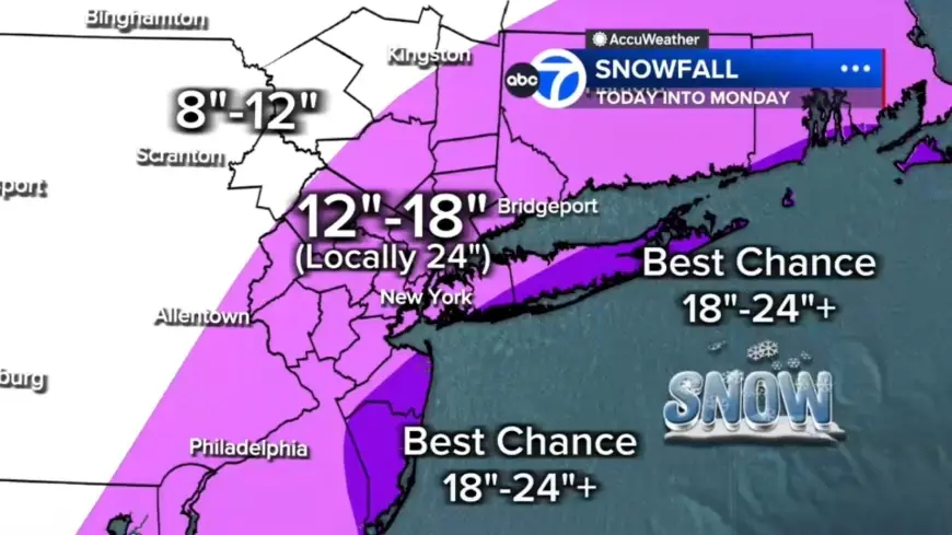
Early measurements highlight widespread double-digit accumulations: Putnam Valley 9 inches; Spring Valley 9. 5 inches; Mott Haven (Bronx) 15 inches; Plainview / Plainedge 11. 5 inches; Ridgefield nearly 12 inches; Glen Ridge over 10 inches; Watchung 14. 4 inches. Most locations are on track to finish between 12 and 18 inches, with locally up to two feet possible in parts of the city and areas south and east where heavier bands persist.
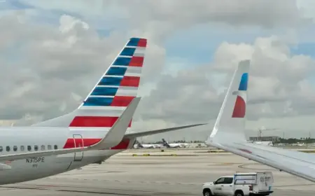
Air travel and cancellations: scale and specifics
Travel infrastructure is already feeling the pressure. More than 14, 000 U. S. flights had been disrupted as of 5: 30 p. m. ET on Sunday: about 8, 858 flights were canceled and another 5, 196 delayed. Major carriers including Jetblue, American Airlines, Delta, Southwest and United announced they would waive change and cancellation fees ahead of the storm. The heaviest snow is expected to begin Sunday night, with potential totals Sunday night into Monday topping 18–24 inches in New York City, Philadelphia and Boston and a broader forecast of 1 to more than 2 feet for parts of the Northeast.
Local damage, safety threats and secondary risks
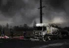
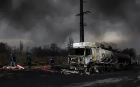
Damage reports have been increasing as winds remain strong. A downed tree was reported along NJ17 near Saddle River early this morning, with additional tree damage noted along Jericho Turnpike and near Westhampton. Strong onshore flow is producing coastal flood advisories and coastal flood alerts that coincide with the high tide cycle. There is also heightened concern about health risks tied to shoveling: a Tennessee man died after suffering a heart attack while shoveling snow, a reminder these storms carry both immediate and indirect human tolls. Forecasters have warned that strong winds combined with the weight of heavy, wet snow will likely result in scattered to numerous power outages.
- More than 40 million Americans are under blizzard warnings.
- States of emergency expanded to include Connecticut, Delaware, Massachusetts and Rhode Island.
- Flight disruptions exceed 14, 000 as of 5: 30 p. m. ET on Sunday (8, 858 canceled; 5, 196 delayed).
- Snow totals: most areas 12–18 inches; locally up to two feet; some city hubs forecast 18–24 inches Sunday night into Monday.
Forecast timeline and immediate expectations
The schedule below captures the progression that is shaping response and travel plans; timing and conditions are unclear in the provided context beyond these windows.
- Now through 9–10 a. m.: Peak blizzard conditions with the heaviest snow, lowest visibility and strongest winds.
- Late morning to lunchtime: Snow begins to taper to lighter, scattered showers.
- This afternoon: Snow moves out but winds remain gusty, with some gusts still possibly approaching 50–60 mph.
- Tonight: Clear but windy with a low near 25 degrees.
- Tuesday into the weekend: Tuesday partly sunny and breezy (high around 31); Tuesday night into Wednesday a chance of a light rain/snow mix; the weekend expected quieter with temps in the mid-40s and calm by Saturday and Sunday.
Maintenance crews have been working on airport infrastructure: snow-clearing operations were noted on a taxiway at LaGuardia Airport as the storm spread, shown in imagery dated Jan. 26, 2026. Separate imagery captured travelers waiting for flights on Nov. 18, 2025, illustrating how airports are focal points during major winter storms. There was also a call for readers to submit weather photos and videos as the situation developed.
It’s easy to overlook, but the bigger signal here is the compound nature of the event: heavy, fast-accumulating snow combined with high winds, coastal flooding potential and large-scale travel disruption. That combination is why officials continue to urge residents to stay home while conditions remain dangerous through mid-morning.
There is still uncertainty about whether the storm will enter record lists, but early coverage notes the storm has a chance of cracking the Central Park top-five snowfall list. The real question now is whether the heaviest bands will remain concentrated over city and southern/eastern zones long enough to push several official totals into the two-foot range.
Key takeaways:
- Immediate hazards: near-zero visibility, 1–2 in. /hour snowfall rates and 40–55 mph gusts in spots.
- Community impact: tree damage, potential power outages and coastal flood advisories tied to high tide.
- Travel impact: more than 14, 000 flights disrupted as of 5: 30 p. m. ET on Sunday; airlines have issued fee waivers.
- Health and safety: shoveling-related risks have already led to at least one fatality; officials urge caution and staying home while possible.
If you are wondering why this keeps coming up: the combination of rapid snow rates, sustained strong winds and coastal timing is what magnifies local impacts from snow totals into outages, downed trees and hazardous travel.