


East Tennessee Winter Weather: Ice Is the Disruptor, and the Power Risk May Outlast the Precipitation

East Tennessee’s next winter system is shaping up as a “thin-layer, big-impact” event: not necessarily the kind that buries the region in snow, but the kind that turns a normal weekend into a chain of road closures, delayed services, and scattered power failures. The main concern is icing—freezing rain and sleet that can glaze bridges, weigh down limbs, and make travel unreliable even where totals look modest on paper. If outages happen, the bigger hardship may come after the last raindrop, when temperatures stay cold enough to keep neighborhoods slick and homes harder to heat.
Why this setup hits harder than many snow events
Ice changes the math. Snow can be plowed and treated; glaze ice turns roads into skating rinks and can cling to trees and lines long after the precipitation ends. The forecast challenge in East Tennessee is that many communities will sit close to the freezing mark, and tiny temperature shifts can flip outcomes street by street—wet roads in one valley, a damaging glaze a few miles away, and sleet or snow on the ridges.
The places that typically feel it first are also the places most likely to feel it worst:
-
Higher elevations in the Smokies and nearby mountains
-
The Cumberland Plateau
-
Far northeastern Tennessee and adjacent higher terrain
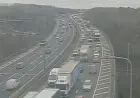
Even in the central valley—including the Knoxville area—the risk isn’t limited to back roads. Overpasses, shaded stretches, and untreated neighborhood streets can become the difference between “fine” and “impassable” quickly.
What to expect: a long-duration mix that evolves as it falls
Current guidance points to precipitation arriving Saturday, intensifying through Saturday afternoon and night, and lingering into Sunday before tapering late Sunday. The hazard window isn’t just the start time—it’s the prolonged period where precipitation type can wobble between rain, freezing rain, sleet, and snow as layers of air warm and cool at different heights.
A reasonable planning assumption for many East Tennessee communities:
-
Valleys: a mix with icing that may range from a light glaze to enough accumulation to cause travel issues and scattered limb damage
-
Plateau and mountains: higher odds of more meaningful ice accumulation, with a greater chance of downed trees/lines and longer restoration times if outages occur
-
North of major corridors and higher terrain: a better chance of snow and sleet mixing in, which can briefly improve traction compared to pure freezing rain—but can also hide ice underneath
It’s also a storm where “ending” doesn’t mean “safe.” Roads can refreeze Sunday night into Monday morning, especially where melted sleet and slush drain across pavement and then lock up again after dark.
Key numbers people should understand (without fixating on exact totals)
-
A trace of ice can be enough to create hazardous driving on bridges and hills
-
A quarter inch of ice starts to strain limbs and lines in vulnerable spots
-
More than that, especially with wind, can shift the risk from “travel disruption” to “infrastructure damage”
Mini timeline for the weekend in East Tennessee
-
Friday (daytime/evening): Final “easy window” for errands, charging batteries, and repositioning vehicles away from overhanging limbs.
-
Saturday (late morning through night): Wintry mix develops and becomes more disruptive; the most dangerous driving often occurs during the first icing transition.
-
Sunday (daytime into evening): Mixed precipitation continues; impacts expand where ice is accumulating faster than crews can treat roads.
-
Sunday night into Monday morning: Refreeze risk grows; slick spots can return even if precipitation has ended.
-
Next signal: the exact placement of the warm/cold line—small shifts will determine whether the valley sees mostly wet pavement or a damaging glaze.
East Tennessee has seen plenty of winter weather, but this is the kind of forecast where the region’s usual instincts can mislead: if you wait to “see how it looks,” you may be waiting until the roads are already compromised. The most useful plan is to treat Saturday afternoon through Sunday as a reduced-mobility period—keep trips short, keep phones charged, and assume that the hardest part could be the quiet hours after the storm, when everything refreezes and power restoration (if needed) becomes slower and colder.