


York Braces for Snow as Temperatures Plunge Below Zero
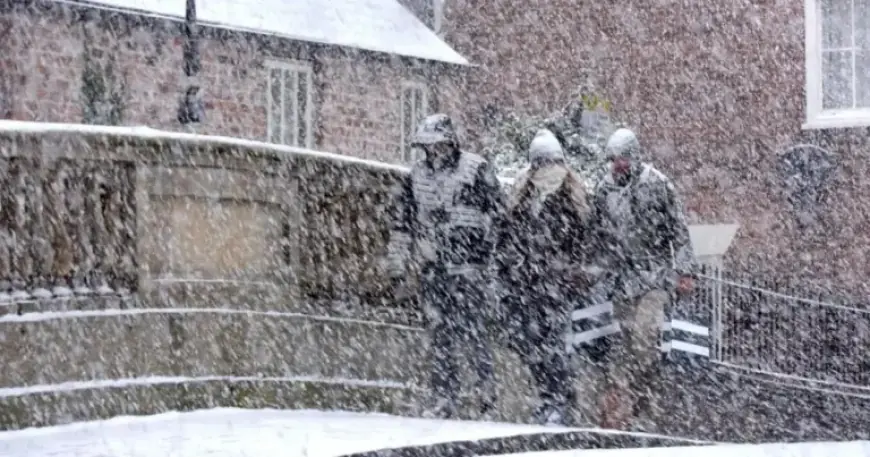
As temperatures plunge below zero, York braces for significant snowfall toward the end of January. According to the latest forecasts, the city’s weather could shift dramatically, bringing sleet and snow over several days.
Forecast Details
BBC Weather predicts the most likely snowfalls to occur on Friday, January 30, and Saturday, January 31. This weather system is expected to be driven by easterly winds bringing cold air and precipitation.
Predicted Snow Accumulation
While forecasters acknowledge some uncertainty in the latter part of the month, they lean towards a colder scenario rather than a mild one. The projected high pressure systems in the northeast and north of the UK will contribute to these conditions.
Previous Weather Patterns in York
- Light snow was reported in York early last Sunday, but it melted quickly due to rising temperatures and rain.
- Many other regions, including the North York Moors and coastal areas, have experienced heavier snowfall, leading to traffic disruptions.
Impacts of Cold Weather
If cold weather patterns prevail, residents can expect temperatures to drop significantly below normal. Additionally, strong winds may create noticeable wind chills, particularly along eastern coastal areas.
The risk of penetrating frosts remains, and residents should prepare for variable snow showers. Some regions could see organized bands of snow, leading to notable accumulations.
Conclusion
As York approaches the end of January, locals need to stay informed about the impending wintry conditions. Preparations for adverse weather may be necessary in anticipation of the upcoming snow.