


Trump Displays U.S. Map Including Canada and Greenland in Photo
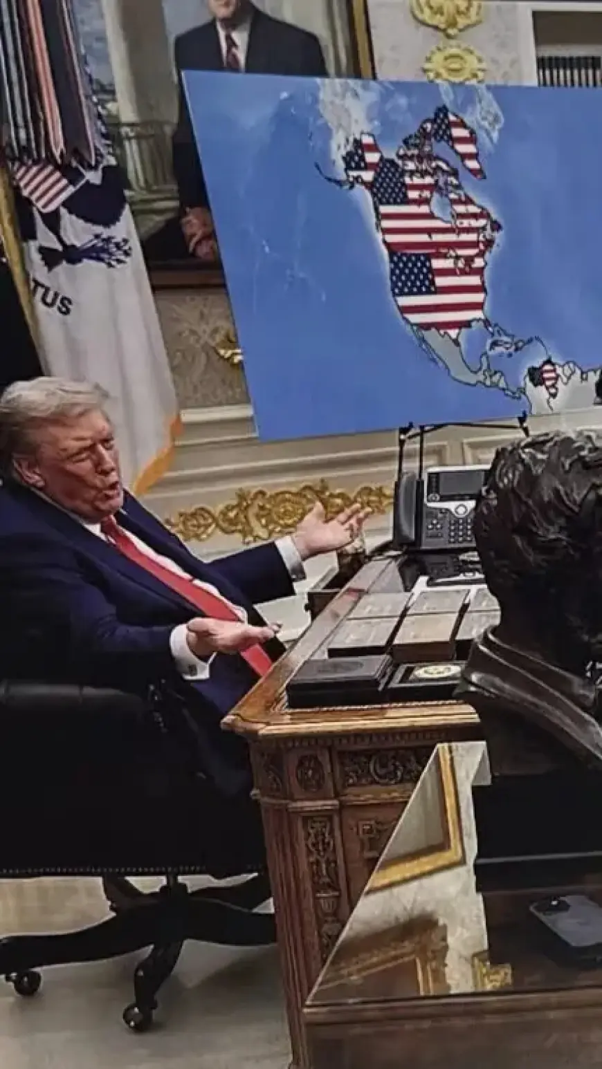
Recently, U.S. President Donald Trump shared a modified map portraying the United States. This image included Canada, Greenland, Venezuela, and Cuba as part of U.S. territory. The altered map sparked significant discussion and controversy due to its implications.
Details of the Altered Map
The map in question deviates from the traditional representation of U.S. borders. This alteration has raised questions about its authenticity and the intent behind such a portrayal.
Context of the Image
The original map was taken from a meeting in August. During this gathering, NATO leaders, including U.K. Prime Minister Keir Starmer and French President Emmanuel Macron, met with President Trump in the Oval Office.
Reactions to the Map
The release of the map has sparked various reactions, both supportive and critical. Analysts and political commentators have pointed out the potential implications of this representation on international relations.
- Controversial depiction of U.S. borders
- Inclusion of Canada and Greenland
- Meeting involved NATO leaders
- Responses from political analysts
As discussions continue, the altered map serves as a reminder of how visual representations can influence public perception and political dialogue. The situation highlights the intersection of geography and diplomacy in the contemporary political landscape.